Garmin Mapsource 6.13.6 vs 6.15.11
As of Mapsource 6.16.1 or Basecamp v3, please regard the article below as historic information. Both 6.16 and Basecamp v3 work more or less flawless, and have many advantages (better route calculation, possibility to show contourlines in case of Basecamp and maps at the same time, better support for newer GPS, .....
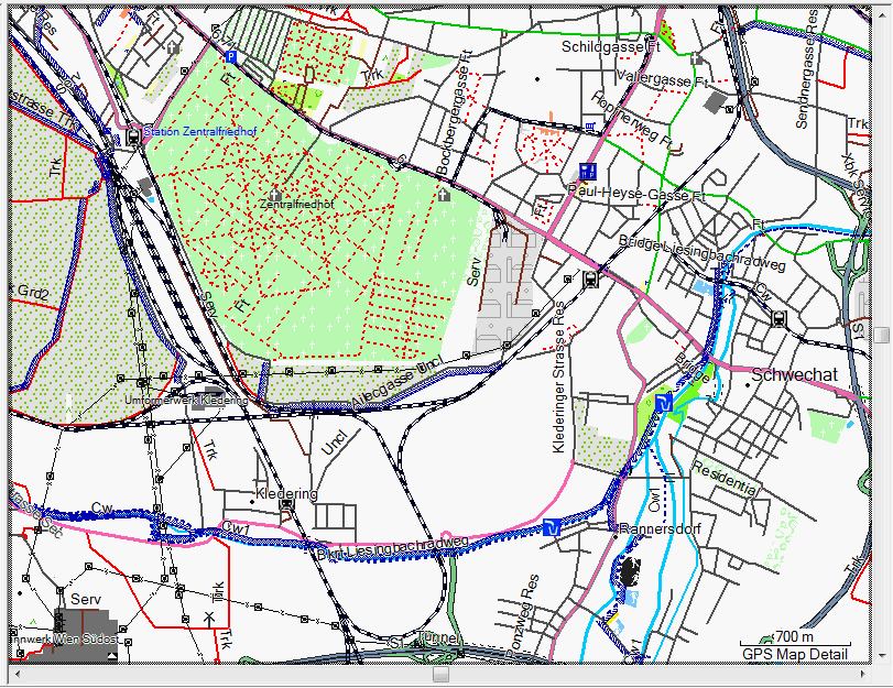
Example in Vienna
O.k. I noticed that many of you simply think that the newer Garmin Mapsource versions do work and display the maps correctly. I wan't to help you to correct that wrong assumption
1. Actually Garmin Mapsource >6.14.1 currently does not display any map correctly, as they are squashed together. The further away you move from the equator, the worse. If you can live with it, fine, I would never accept it. (it means that 10cm horizontal on your screen, do not represent the same length as 10cm vertical). A square becomes a simple rectangle.
On top 6.13.6 - below 6.15.6 (though that should not be hard to guess)
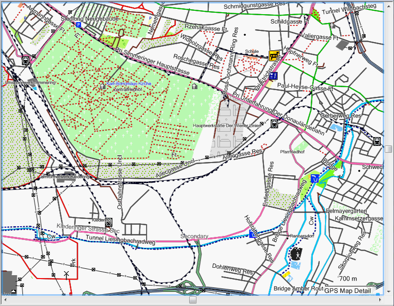
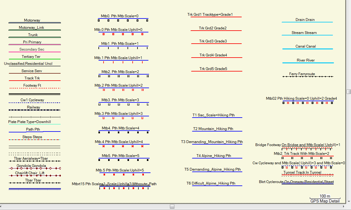
Example showing the maplegend
Mapsource 6.15.7 and higher now shows the map legend correctly (apart from the broken projection fixed to Garmins Headquarters, the higher up north you live the worse).
Again 6.13.6 on top of the lower Image is still from Mapsource 6.15.6 which is why mtb attributes were not shown correctly. However Garmin Basecamp still displays maps incorrect as below.

Downgrade Garmin Mapsource if you are using a newer version
3. There are several other problems with newer Mapsource version, do yourself a favour, and downgrade. Writing and complaint e-mail to Garmin about broken Mapsource is never wrong either. How to downgrade is written here https://openmtbmap.org/tutorials/install-mapsource/ :
“Auf Garmin Mapsource 6.13.6 downgraden”
Muß das nicht 6.16.3 heißen?
Der Artikel ist sehr alt. 6.13.6 war die beste Version bevor 6.16 erschien. Und es ist die letzte Version die ohne Cache funktioniert – also die Karten Nördlich/südlich der Kartenmitte nicht verzerrt.