Premium Gmapsupp.img – directly for Garmin GPS units

Sorry the downloads on this page are only for OpenMTBMap members - get a Membership here https://openmtbmap.org/support/membership/

To Try Out you can download the map of Austria (and contourlines) for free! All other maps are only for members.

You can also download the Desktop version of most countries for free here: https://openmtbmap.org/download/odbl/:

InstructionsNon Unicode DownloadsUnicode DownloadsContourlines 20mContourlines 10mVelo Buildings

Why should you download the gmapsupp.img format maps?

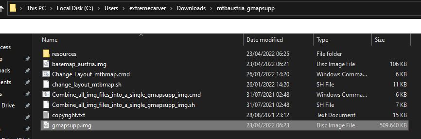
For simplicity, I've now also made all countries available as gmapsupp.img download - which after unpacking - you can directly move onto your GPS device. Europe, Africa and Asia as full continent maps are too big to offer as gmapsupp.img maps - the Europe continent contourlines are available as gmapsupp.img download however.

Note - this way you loose the possibility to only upload a part of a map to your device as you could do using MapInstall (or Mapsource for Windows users). The advantage is that you can very quickly change the layout (on both Windows, as well as Mac OS x or Linux), and that it's the quickest and easiest way.

If you want to use the maps for planning on your desktop - then you will need the Desktop map too or instead. Note: If you plan a route in Basecamp on your desktop - you should use exactly the same map on your device (so same date, same country - but Unicode/Non Unicode does not matter - so you could use Non Unicode map on your GPS device if needed, and Unicode map on your Desktop/Notebook)


Video Tutorial - if you prefer watching this as a video instead of reading through the text:


- Map Data

All maptiles are compiled with mkgmap using map data from openstreetmap.org & Contributors. You can use and edit the map data by visiting openstreetmap.org.

Contourlines/DEM data:

The altitude data for the contourlines is from varying sources in the following priority (if available):

  1. LIDAR data from open government data and other openly available sources - collected and converted to hgt format by - Sonny - DEM Altitude Profiles This data is very very high quality and resolution - there is no better open data available according to my knowledge.
  2. ALOS World 3D30 - überall zwischen N60° und S60°
  3. SRTM 1" v3.0 - very rarely for some tiles missing in ALOS data - also only between N60° and S60°.
  4. Viewfinderpanormas 1" - then 3" - above N60° / below S60° as there is no SRTM data nor ALOS or LIDAR Data avialble.
  5. SRTM v3.0 by NASA 3" v3.0 (very very rarely, 8 tiles only)

more exact info which data is used where - inside the copyright.txt files.


Installation:

Unpack with 7-zip (lzma2) .  Recommended tools to unpack:


The unpacked gmapsupp.img download and contents

Highlighted here the gmapsupp.img that you need to move into the Garmin folder (not any subfolder) of your device. If the device accepts mSD cards - always put it onto the SD and not into the internal memory (only for testing if the mSD card has problems use internal)

  • basemap_austria.img - usually not needed. Only if you deleted the basemap from Garmin by accident.
  • change_layout_mtbmap.cmd - For windows a script to change the layout. Do it before sending the map to the device
  • change_layout_mtbmap.sh - For linux or older Mac OSx versions to change the layout - do it before sending the map to the device.
  • Combine_all_img_files_into_a_single_gmapsupp... - Scripts for Windows/Linux/older OSx to merge several gmapsupp.img files together. Only needed on very old devices not supporting several gmapsupp.img files (like etrex Vista HCx or GPSMaps 60 CSx - pre 2011 or so)
  • gmapsupp.img - you can rename it to e.g. mtbaustria.img before sending to mSD on Garmin GPS devices newer than 2011. This is the only file you need to copy to the mSD (you could copy the scripts and resources too - they will do no harm)


The default layout is "wide" - the layout optimised for most modern garmin GPS units with comparably high DPI. 

Move the gmapsupp.img file to the /garmin folder on your mSD of your Garmin GPS unit. Note the contourlines (altitude height lines) are always a separate second download - so updates are smaller as the contourlines rarely change. The second reason why contourlines are a separate download is that this way you can change contourlines layout independently from the map layout.


If you want to move several countries to your device - you will need to rename the gmapsupp.img file. E.g. just call it mtbmap_Austria.img. Make sure not to use Umlauts or custom symbols ("_"  is okay, better not use " "space. Latin alphabet only)


Make sure that the mSD of your Garmin GPS unit is FAT32 formatted. Else it cannot be read by your device. Second - do not forget that most new Garmin GPS devices cannot read Unicode maps - so in that case for maps that have (Unicode) after the name, resort to the non Unicode maps instead.


If you have not used OpenMTBMaps before - please read through the topic about Autorouting: https://openmtbmap.org/about-2/autorouting/

Map Legend - look at it too so you can understand the map layout better: https://openmtbmap.org/about-2/map-legend/


Compatibility - Unicode vs Non Unicode (cannot authenticate maps)

Unicode is needed to display several alphabets in one map. Non Unicode maps can only display a single alphabet - e.g. kyrillic and latin - but not both. However Garmin blocked using Unicode maps in part of a broken copyright protection on newer GPS device series.

Newer Garmin devices cannot use free unicode maps (except if you hack the firmware) - usually a "cannot authenticate maps" message which show on boot. The following Garmin outdoor devices are affected:

  • All Garmin devices presented 2016 or newer
  • Edge 1000
  • Epix
  • Etrex 20x / 30x (not "etrex 30")
  • Etrex Touch 25/35
  • GPS Maps 64 series
  • Montana 610, 680
  • Oregon 700,750
  • Some recent Nuvi devices - as well as some super old devices that do not support Unicode. (E.g. Garmin Vista C, GPS Maps 60 C)

you will need to download the "Non Unicode" version of the map. Only maps of regions where several different scripts are used - are in unicode. I've listed the non unicode maps however also unter the unicode header for convenience (actually only maps with (unicode ) following their name are actually in unicode.

Also english version of maps is only available for countries/regions not using latin only.


Garmin Edge x30 or newer

Garmin introduced a completely broken high contrast mode - that washes out the colors of the maps. Either disable the high contrast mode on the map visibility section. Or delete the \Garmin\MapThemes\Mountain.kmtf (sometimes also called \Garmin\MapThemes\Mountains.kmtf ) file (back it up if you think you ever want to use that mode. Since the newest firmware in July 2021 you need to enable classic mode - 

Activity Profiles, select a profile, and select Navigation > Map > Map Theme > Classic

Classic: This shows the OpenMTBMaps / VeloMaps as intended, however POI are now shown from Edge profile. 
High Contrast: Complete fuckup by Garmin - because they are not able to make their own maps high contrast in first place.
Mountain Biking: Complete fuckup by Garmin - because they are not able to make their own maps high contrast in first place.


Language and Codepage

Default - Local Language Unicode. All labels / street names are exactly like in the name tag of OSM. Note for any country that uses latin - the default will be latin1 and the options below are not available. An exception is the South America continent map that is additionally available in English Non Unicode. For USA/Canada this is also the only option. For European countries using latin if you want the English version - you can use the European continent map that is available in English versions.

English Unicode: If available in OSM - English or other European language translation is used. If no translation is available in OSM, the local name tag is used.

Local Language Non Unicode: Same as default but instead of Unicode the local codepage is used. So some characters may need to be transcribed automatically in creation. Codepage is always the local default codepage.

English Language Non Unicode (always latin1): If available English or other European language translation from OSM is used. If not names are transcribed to Latin. 


SD Cards

This is not about the maps but in general Garmin units that have a microSD card slow only accept SDHC cards - SDXC cards will not work.  Max 32GB size and you need to format it with FAT32 (not exFAT). Be careful with 32GB cards which are available as both SDHC and SDXC. 16GB and smaller usually are always SDHC.


Adapting The Map Layout 

It's very easy to chose a Map layout:


Windows Users - Options:

a) After unpacking just doubleclick the change_layout_mtbmap.cmd it will ask you which layout to chose - and within 2-3 seconds it will be changed.

For the contourlines gmapsupp.img downloads run the change_layout_contourlines.cmd after unpacking. This way you can choose how dominant/thick/thin the contourlines are displayed. By default your device does this automatically - but you can change it to your liking this way.

b) You can also drag or drop any OpenMTBMap gmapsupp.img file directly onto the change_layout_mtbmap.cmd - that's very useful if for example you want to change the layout of an openmtbmap gmapsupp.img file that is already on the mSD of your device. No need to move it back to your desktop. Just drop it onto the change_layout_mtbmap.cmd and the layout can be changed within seconds. 

Note 1: never drop a contourlines gmapsupp.img file onto the change_layout_mtbmap.cmd - else you will end up with a very strange looking map if the script/program runs at all.

Note 2: Never drop a gmapsupp.img file created with MapInstall or Mapsource onto the change_layout_mtbmap.cmd if it contains several different maps. In that case you will lose the layout for all but one map inside the gmapsupp.img container.

c) Advanced users only - run from cmd.exe terminal:

change_layout_mtbmap.cmd gmapsupp_Austria.img wide.TYP

The first argument is the name/location of the gmapsupp.img file, the second the .TYP-file . It's easiest to just drag all three files after each other into the terminal. Note - if you want to pass a custom .TYP-file, you have to give the first argument about gmapsupp.img location too. You can also only pass

change_layout_mtbmap.cmd gmapsupp_Austria.img

 
Mac OSx and Linux users:

Note - not possible anymore with macOS v10.15 or newer. gmt_osx is 32bit only and the author does not plan to release a 64bit version.

Note - if you don't open the terminal in the directory of the .sh file - then first go per "cd"

into the correct folder/directory - then

a) open terminal and run:

bash change_layout_mtbmap.sh

a1) instead of running the script via terminal - make it executable.

either via file properties or in terminal with:

chmod u+x change_layout_mtbmap.sh

Now you can start the script by doubleclick. You can also just drop a gmapsupp.img file in your file explorer/finder onto the script in order to change that gmapsupp.img layout.

The contourlines layout can be changed just the same way using the change_layout_contourlines_gmapsupp.sh script.


b) for advanced users - in terminal run:

bash change_layout_mtbmap.sh gmapsupp.img

or 

bash change_layout_mtbmap.sh gmapsupp.img wide.TYP

The first argument has to be the gmapsupp.img file - the optional second argument is the .TYP file (if you want to add a custom .TYP file)

Note 1: never drop a contourlines gmapsupp.img file onto the change_layout_mtbmap.sh - else you will end up with a very strange looking map if the script/program runs at all.

The contourlines layout can be changed just the same way using the change_layout_contourlines_gmapsupp.sh script.

Note 2: Never give a gmapsupp.img file created with MapInstall to change_layout_mtbmap.sh if it contains several different maps. In that case you will lose the layout for all but one map inside the gmapsupp.img container.


Map Visibility in Basecamp

By default I've disabled that maps are loaded for display/to show in Basecamp. However if you like to see the map when connecting the GPS device or mSD card to your computer with Basecamp open - you can run the change map layout script (see Adapting the Map Layout above) - at the end of the script you will be asked to enable or disable the Basecamp Map Visibility.


Joining gmapsupp.img files for very old devices 


Very old devices - Join gmapsupp.img files

Very old devices like etrex vista HCx or GPSMaps 60 CSx - can only use one map file - called gmapsupp.img (max size 4GB). Now if you would like several countries or map plus contourlines to show - you need to join the .img files first.

To do that - add the additional .img files (e.g. contours_austria.img) to the extracted folder of the map. Then run the script:

Combine_all_img_files_into_a_single_gmapsupp_img


On Windows you simply doubleclick the Combine_all_img_files_into_a_single_gmapsupp_img.cmd script.


on OSx or Linux you open the the .sh script from terminal by

bash Combine_all_img_files_into_a_single_gmapsupp_img.sh

(or chmod u+x to make it executable first, then run it by doubleclick).

Note - if you don't open the terminal in the directory of the .sh file - then first go per "cd"

into the correct folder/directory.

Note -this is not possible anymore with macOS v10.15 or newer. gmt_osx is 32bit only and the author does not plan to release a 64bit version.


Standard - Local Language Maps
OpenMTBMap

Continents map downloads:

Openmtbmap Europe Downloads:


German Bundeslaender Downloads:

Openmtbmap France DOM-TOM:

Africa  map downloads:

Asia  Map Downloads :

Australia-Oceania map downloads:

North America Map Downloads: 

For an Overview of the areas covered by the US-extracts please visit: https://openmtbmap.org/support/north-america/

South America Premium map downloads

VeloMap

Continents map downloads:

VeloMap Europe Downloads:


German Bundeslaender Downloads:

VeloMap France DOM-TOM:

Africa  map downloads:

Asia  Map Downloads :

Australia-Oceania map downloads:

North America Map Downloads: 

For an Overview of the areas covered by the US-extracts please visit: https://openmtbmap.org/support/north-america/

South America Premium map downloads

English Language Maps
OpenMTBMap

Europe map downloads:

Africa Map Downloads 

Asia Map Downloads


North America


VeloMap

Europe map downloads:

Africa Map Downloads 

Asia Map Downloads


North America


Standard - Local Language Maps
OpenMTBMap

Continents Map Downloads:

Openmtbmap Europe Downloads:

German Bundeslaender Downloads:

Openmtbmap France DOM-TOM:

Africa  Map Downloads:

Asia Map Downloads:

Australia-Oceania Map Downloads:

North America Map Downloads: 

For an Overview of the areas covered by the US-extracts please visit: https://openmtbmap.org/support/north-america/

South America Premium map downloads:

VeloMap

Continents Map Downloads:

VeloMap Europe Downloads:

German Bundeslaender Downloads:

VeloMap France DOM-TOM:

Africa  Map Downloads:

Asia Map Downloads:

Australia-Oceania Map Downloads:

North America Map Downloads: 

For an Overview of the areas covered by the US-extracts please visit: https://openmtbmap.org/support/north-america/

South America Premium map downloads:

English Language Maps
OpenMTBMap

Continents Map Downloads:

Openmtbmap Europe Downloads:

Africa Map Downloads:

Asia Map Downloads:


North America


VeloMap

Continents Map Downloads:

VeloMap Europe Downloads:

Africa Map Downloads:

Asia Map Downloads:

North America

The following contourlines are with the standard recommended equidistance of 20m. In mountaineous regions I recommend to use 20m equidistance. However as of popular demand you can alternatively download 10m equidistance for all countries and continents (except Asia continent map - because it is too large). Note that the underlying data outside of Europe in mountaineous regions is actually not good enough to really profit from 10m equidistance lines at all. For flat regions however worldwide 10m contourlines can make sense. So that's why I offer them for download worldwide.

In general I recommend not to install more than 6-8GB of maps on your device at any time. As the contourlines do not have an address index or any POI they don't count towards that limit - as they will not slow down your device like normal maps do.

Do note however that all Garmin devices have a max tile limit of 2048 or 4096 - so do not forget about that. The South America contourlines 10m for example already have about 3000 tiles.  So better just export those ones that you need by using the windows or osX gmapi download instead and send with MapInstall. (that is alsow why there are not Asia gmapsupp 10m contourlines - they would break the 4096 tile limit.)

If you break the 2048 or 4096 tile limit - some tiles simply will not be shown - which ones I cannot tell you - that's random.  Be very careful about this limit if you go for the 10m contourlines for a continent - or if you insist to install the 20m Asia continent gmapsupp contourlines (also over 3000 tiles).

I cannot tell you for gmapsupp.img downloads consisting of several gmapsupp.img maps which map covers which part. That is a bit random too. You can look at the gmapsupp.img map coverage by loading them in QmapShack.

Continents Contourlines 20m:

Europe Contourlines 20m:

German Bundeslaender 20m:

France DOM-TOM 20m:

Africa Contourlines 20m:

Asia Contourlines 20m:

Australia-Oceania Contourlines 20m

North America Contourlines 20m: 

For an Overview of the areas covered by the US-extracts please visit: https://openmtbmap.org/support/north-america/

  • us-midwest (MD5) (from North Dakota in the Northwest to Detroit / Akron in the Norteast, to Missouri in the Southeast and Kansas in the Southwest)
  • us-northeast (MD5) (northeast of Pittsburgh and Philadelphia)
  • us-pacific (MD5) (Alaska, Hawai and other Pacific Islands)
  • us-south (MD5) (south of Baltimore, Louisville, Tulsa / Oklahoma City)
  • us-west (MD5) (west of Denver, Colorado Springs, Albuerque -- complete N/S or Canada to Mexiko)

South America Contourlines 20m:

The following contourlines are with equidistance of 10m. In mountaineous regions I recommend to use 20m equidistance instead. However as of popular demand you can alternatively download 10m equidistance for all countries and continents (except Asia continent map - because it is too large). Note that the underlying data outside of Europe in mountaineous regions is actually not good enough to really profit from 10m equidistance lines at all. For flat regions however worldwide 10m contourlines can make sense. So that's why I offer them for download worldwide.

Also in Europe only where there is LIDAR coverage 10m contourlines make sense in mountain regions. Inside the copyright file you can find out the data sources.

In general I recommend not to install more than 6-8GB of maps on your device at any time. As the contourlines do not have an address index or any POI they don't count towards that limit - as they will not slow down your device like normal maps do.

Do note however that all Garmin devices have a max tile limit of 2048 or 4096 - so do not forget about that. The South America contourlines 10m for example already have about 3000 tiles.  So better just export those ones that you need by using the windows or osX gmapi download instead and send with MapInstall. (that is alsow why there are not Asia gmapsupp 10m contourlines - they would break the 4096 tile limit.)

If you break the 2048 or 4096 tile limit - some tiles simply will not be shown - which ones I cannot tell you - that's random.  Be very careful about this limit if you go for the 10m contourlines for a continent - or if you insist to install the 20m Asia continent gmapsupp contourlines (also over 3000 tiles).

I cannot tell you for gmapsupp.img downloads consisting of several gmapsupp.img maps which map covers which part. That is a bit random too. You can look at the gmapsupp.img map coverage by loading them in QmapShack.

Continents Contourlines 10m:

Europe Contourlines 10m:

German Bundeslaender 10m:

France DOM-TOM 10m:

Africa Contourlines 10m:

Asia Contourlines 10m:

Australia-Oceania Contourlines 10m

North America Contourlines 10m: 

For an Overview of the areas covered by the US-extracts please visit: https://openmtbmap.org/support/north-america/

  • us-midwest (MD5) (from North Dakota in the Northwest to Detroit / Akron in the Norteast, to Missouri in the Southeast and Kansas in the Southwest)
  • us-northeast (MD5) (northeast of Pittsburgh and Philadelphia)
  • us-pacific (MD5) (Alaska, Hawai and other Pacific Islands)
  • us-south (MD5) (south of Baltimore, Louisville, Tulsa / Oklahoma City)
  • us-west (MD5) (west of Denver, Colorado Springs, Albuerque -- complete N/S or Canada to Mexiko)

South America Contourlines 10m:

Many people prefer to not see buildings using the VeloMap in cities. Sadly I cannot filter buildings based on if they are on the countryside or in a city. If you are not interested in the buildings - removing them makes the map faster to pan around - and will save a little bit of battery (the speed difference will be big on older Garmin GPS devices - but nearly not noticeable on newer Garmin GPS devices. Besides of course if you are not interested in the buildings - not seeing them helps with contrast and you can focus on the streets/ways. Other people prefer to see the buildings. For Right now I only move the buildings to a separate layer for the VeloMap - for off road use/ Mountainbiking in general I think that buildings should be shown. I may create that additional layer in future for openmtbmap too if there is demand.

Just as above for the contourlines - copy the gmapsupp.img file into the Garmin folder on your GPS devices mSD card (or internal memory if your device has no mSD card).


In general I recommend not to install more than 6-8GB of maps on your device at any time. As the buildings do not have an address index or any POI they don't count towards that limit - as they will not slow down your device like normal maps do.

Do note however that all Garmin devices have a max tile limit of 2048 or 4096, or around 15000 tiles - so do not forget about that.  If you break the 2048 or 4096 tile limit - some tiles simply will not be shown - which ones I cannot tell you - that's random.  Be very careful about this limit if you go for continent gmapsupp.img downloads of Europe or Asia. Asia is only possible with contourlines and buildings on devices with 15.000 tiles limit. Europe likely soon break the 4096 tile limit.


Non Unicode Buildings
Local Language
Continents buildings downloads:

Europe downloads:

German Bundeslaender Mac OSx downloads:

France - DOM-TOM:

Africa downloads:

Asia Downloads :

Australia-Oceania Mac OSX downloads:

North America Mac OSX downloads

  • us-midwest (MD5) (from North Dakota in the Northwest to Detroit / Akron in the Norteast, to Missouri in the Southeast and Kansas in the Southwest)
  • us-northeast (MD5) (northeast of Pittsburgh and Philadelphia)
  • us-pacific (MD5) (Alaska, Hawai and other Pacific Islands)
  • us-south (MD5) (south of Baltimore, Louisville, Tulsa / Oklahoma City)
  • us-west (MD5) (west of Denver, Colorado Springs, Albuerque -- complete N/S or Canada to Mexiko)

South America Mac OSX downloads

Unicode - Buildings
Local Language

Continents Mac OSX downloads:

Europe Mac OSx Downloads:

German Bundeslaender Mac OSx downloads:

France - DOM-TOM:

Africa Mac OSX downloads:

Asia Mac OSX Downloads

Australia-Oceania Mac OSX downloads:

North America Mac OSX downloads

  • us-midwest (MD5) (from North Dakota in the Northwest to Detroit / Akron in the Norteast, to Missouri in the Southeast and Kansas in the Southwest)
  • us-northeast (MD5) (northeast of Pittsburgh and Philadelphia)
  • us-pacific (MD5) (Alaska, Hawai and other Pacific Islands)
  • us-south (MD5) (south of Baltimore, Louisville, Tulsa / Oklahoma City)
  • us-west (MD5) (west of Denver, Colorado Springs, Albuerque -- complete N/S or Canada to Mexiko)

South America Mac OSX downloads

English Language Maps - ONLY for Countries not using Latin

Continents Mac OSX downloads:

Europe Mac OSx Downloads:

Africa Mac OSX downloads:

Asia Mac OSX Downloads

North America

190 comments to Premium Gmapsupp.img – directly for Garmin GPS units

  • buehre

    Hi Felix

    is there a way to combine contours an country map img into one file? I want to use the img files for the edge directly in basecamp (using a virtual disk) instaead of install them separatly. this works perfectly for all single img files but in bascamp, there is no way to display two img as an overlay as you do it on the garmin edge. I tried to use the combine command but map does not work/occour in bascamp then… any idea?
    René

    • extremecarver

      I never tried that – I guess maybe Basecamp expects them in a single mapset? What happens if you export a map with Mapinstall – is the resulting img read correctly into basecamp? You could try the create gmapsupp script which has two modes if they work. But yeah I will not write a script to emulate that. Because it would mean dissasembling the gmapsupp files with gmaptool into single .img files – then using those single .img files to build them into a new gmapsupp.img (now containing one mapset only and not two as done with the combine script).

  • hulster

    Hi Felix,

    wäre es vielleicht möglich in zukünftigen Updates die .img spezifisch zu benennen, wie z.B. bei den Höhenlinien. Würde eine Aktualisierung etwas komfortabler machen. So muss man immer erst umbenennen. Und ganze Europakarte geht auf den 830 leider nicht drauf.

    Dank und Gruß

    • Ayasha27

      Hi Felix, I think this is made because of the older devices that accept only one Gmapsupp.img (I can remember it of one of my old ones).
      Hi Felix, Ich denke das ist wegen den älteren Geräten gemacht die nur die Gmapsupp.img annehmen. (Ich kann mich an das Verhalten bei einem meiner ganz alten erinnern früher).

    • extremecarver

      Oh sorry, die Frage habe ich übersehen. Ja ich habe es so gelassen wegen den ganz alten Geräten da dort eben nur der Name akzeptiert wird. Die Höhenlinien separat haben daher schon eigenen Namen.

      Evtl kann ich es bald aber wirklich ändern. Die Generation 60CSx, Vista HCx ist kaum mehr vorhanden (da die Gummi Knöpfe nicht mehr funktionieren)

  • Werner331

    Hi, kann ich auch die Karte von NRW mit Belgien verbinden? Ich bin dort länderübergreifend unterwegs. GARMIN EDGE 705
    Vielen Dank. Gruß, Werner

  • Bigboys67

    Bonjour,
    Je cherche une carte de Cuba.
    Merci

    • extremecarver

      C’est partie de Central America continent map. Comme c’est pas grand il n nexiste pas raison pour faire une carte special pays.

  • aldopani

    Hi Felix, I have a problem with Garmin Edge Explore, I downloaded and copied the .img file (Italy 20-08-22) in Garmin directory of the device, but to see the map I must keep active the old .img file; if I deactive it, I don’t see any map. How can I fix it? No problem instead with Epix 2.
    Many thanks in advance
    Aldo – Cremona, Italy

    • extremecarver

      You shall never install the same map twice! If I understand you correctly you have an old version of the Italy map already on the Explore? Then you need to delete that one first. Be happy you didn’t put your Explore into a bootloop. Same map never twice! Disabling is useless in this regard.

    • aldopani

      Thanks Felix, I’ve deleted the old file, all ok, Explore works well! Sorry for the mistake, I didn’t know that was dangerous to copy the same map twice.
      Have a good day and thanks again.
      Aldo

  • tommyjiang

    China non-unicode english map can not display on my zumo xt maplist, but Japan non-unicode english map can.

    • extremecarver

      China non unicode english should definitely work. Remove all other maps (not from me) – I guess there is some FID overlap or too many maps.

  • B

    Hallo Felix Ich habe gerade Augustkarten heruntergeladen. Dop Ich muss auch die Topo-Lines-Dateien herunterladen oder kann ich die älteren verwenden? Vielen Dank, dass Sie einen fabelhaften Tag haben – und nein, ich kann immer noch kein Deutsch, aber Google tut es! :0)

  • ELLAbikes

    Hallo Felix,
    ich müsste wissen, welchen Bereich genau die Alps Karte abdeckt. Du hast am 25. Juni schon auf eine ähnliche Frage geantwortet, aber ich werde da aus deiner Antwort nicht schlau, denn ich sehe die Abbildung nicht…
    Besten Dank im Voraus!

    • extremecarver

      Ketzelsdorf im Nordosten nach Veurey-Voroize im Südwesten – ein Viereck. Es fehlt also im Südwesten etwas von den Alpen sowohl in Frankreich als auch in Italien.

  • benruddle

    Sorry my post should read that I can not get Europe to down load but I can get South America to down load.

    • extremecarver

      Please tell me which download exactly – and best copy in the link as you see it. Are you redirected to the donation page? Try reloading the download page with SHIFT-F5 to clear cache.

  • benruddle

    Hello I can get the Europe one to down load, I can get the South America one to down load?

    Any help would be great.

    I love what you do it makes my mob travels so easy. Thanks.

  • Turan

    welche Alpen beinhaltet die Karte mtbalps.
    ich habe die Transalpin V4 Pro. wenn ich die mtbalps auf mein Garmin Oregon 750 Installiere brauche ich noch die Transalpin karte!

    Danke

    • extremecarver

      Hier siehst du den genauen Ausschnit welcher abgedeckt wird – im Prinzip fehlt nur in Frankreich, Südwestitalien ein ganz wenig – da musst du auf die Länderkarten – oder Europakarte von mir ausweichen.

  • radler

    Hallo Felix,
    Deine Antwort vom 17.6.22 bezüglich der richtigen Einordung der Karte für gps-Gerät in den /garmin habe ich gemacht. Ergebnis: die auf der SD-Karte im richtigen Ordner installierte Karte wurde im Gerät nicht einmal angezeigt. Es folgte ein neuer Versuch mit Hilfe des Kapitels “Premium Gmapsupp.img- direkt für Garmin Gas-Geräte”. Ergebnis: nur der Name der Datei wurde angezeigt: opemtbmap-cntrs10m-DE-12-Jul-2021. Aktivierung ging nicht.

    Dagegen wurde eine neue Karte für Deutschland für BaseCamp erfolgreich installiert.

    Was mache ich falsch. Bis ca 2018 habe ich unter Windows keine Probleme mit der Erstellung von Karten gehabt.

    • extremecarver

      Dein Probem ist ziemlich sicher:
      a) du hast noch eine alte Deutshcland Karte von mir am GPS Gerät – entferne diese
      b) du hast eine andere Karte – nicht von mir, ziemlich sicher nicht von Garmin, mit derselben FID. Entferne alle anderen Detailkarten (Dateiendung umbenennen)
      c) du hast zu viele Karten am GPS Gerät (über 10-15GB).

      Denn die cntrs ist die reine Höhenlinienkarte – die funktioniert ja scheinbar (aktiviere sie und zoome rein – die Höhenlinien sollten angezeigt werden). Oder du hast einfach nur die Höhenlinien gmapsupp.img übertragen, aber nicht die Karten gmapsupp.img

  • christoph.theuermann

    Hy, dachte das die Mietgliedschaft eigentlich nicht ausläuft. Vielleicht kannst du mal nachsehen ob das tatsächlich so ist. Ich hätte da noch eine Frage zu den Karten. Bekomme ich die auch auf meine Zumo XT und sind die dann routing fähig?

    Danke und Grüße

    • extremecarver

      Hallo Christoph, du hast sowei ich sehen kann nur 2018 für 2 Jahre bezahlt (zumindest von deiner email/deinem Namen)- also schon lange ausgelaufen (du kannst ja jederzeit wieder aktivieren). Ja am Zumo XT sind die auch routingfähig – aber halt für Mountainbikes/wandern oder die VeloMap für Fahrrad/Rennrad. Motorrad oder KFZ kannst du nicht vernünftig autorouting nutzen (da du Zumo schreibst – da weiß ich nicht wofür du autorouting nutzen möchtest).

  • Einsteinium

    Hi, leider scheint der aktuelle Upload der 7z mtb Deutschland (Premium Gmapsupp.img) im Eimer zu sein, habe es mehrfach versucht herunterzuladen und immer kommt eine Fehlermeldung beim Entpacken (unsupported command…) . Die Velo hingegen funktioniert einwandfrei. Könntest du das mal prüfen?

    • extremecarver

      Geprüft und funktioniert. Überprüfe die MD5 Checksum dein Download hat was (evtl irgendwo kaputt gecached und neues klicken auf Download bringt dir wieder nur den kaputten Download – versuche anderen Browser oder anderen PC).

  • f.moser78@gmail.com

    Hallo Felix

    Anbei der gewünschte Printscreen.

    • extremecarver

      logisch – nur die gmapsupp.img gehört in den Garmin Ordner. du hast die kompletten Ordner verschoben (und die Anleitung ignoriert)

  • huubvanloon@gmail.com

    There seems to be a mis match between the US West MTB map and the corresponding contour (20m) map. No matter what I try (nothing, renaming files, copying/moving files), I cannot get the installer to install the contour map. It will act like it is installing, but gives an error message when it is done. I followed the instructions of the error message twice, no result other than the error message.
    Installed the map without the contour lines, that worked.

    • extremecarver

      No – it’s all right. I just downloaded us-west and us_west_contours.7z and it installed perfectly. Check the md5 checksums or check that maybe you did not accidentally download mid-west instead of west or whatever. Another try – delete the us-west map. Delete the folder by hand – and reinstall. It’s possible that if the installer is breaking up at a wrong time once – you need to fully start new again because it will believe the contourlines are already present when it actually failed extracting them.

  • thebishi

    Hallo,
    Kurze Frage, Werden beim Fenix Layout irgendwelche Informationen weggelassen? Mir ist aufgefallen dass manche Weiher und ähnliches nicht „beschriftet“ sind, oder fehlt das allgemein? Wenn ich die originalen OSM Daten aufrufe sind die Namen vorhanden. Grüße

    • extremecarver

      Informationen nicht – Labels sind auf der Fenix generell spartanisch. Wobei es kann sein dass ich es noch etwas reduziert habe aber eher bei POI. Ich weiß nicht was du mist originale OSM Daten meinst – du meinst openstreetmap.org?

      • thebishi

        Ja genau das meine ich. Kann man das mit den Labels irgendwie ändern? Wenn ich in mit fremden Gebieten unterwegs bin , wäre es schön zu wissen was ich da vor mir habe. Muss ich da ein anderes Layout wählen ?

        • extremecarver

          probiere mal ein anderes Layout ob du dann die Labels siehst – ich habe das Fenix Layout auf dem Race – also Rennrad Layout basiert ursprunglich.

  • sandro82

    Hat sich erledigt
    Danke

    • extremecarver

      Europa Kontinent, und nicht vergessen Fenix layout auswählen. Dann Ausschnitt senden. Viel Spaß

      • sandro82

        Jetzt hab ich die normalen Karten (img) geladen und direkt auf die Uhr geladen… nicht gut ?

        • extremecarver

          Doch, aber Du solltest das Layout ändern vorher. Geht aber nur unter Windows oder Linux, nicht vom Mac.

          • sandro82

            Hmm, hab weder Windows noch Linux. Hab nur ein Mac. Und jetzt ?

            • sandro82

              Hi,
              hab jetzt ein Windows Rechner geliehen und die Karten endlich auch auf die Uhr bekommen inkl. Fenix Layout. Sollte man die Höhenlinien auch in der Optik anpassen und wenn ja auf welche Einstellung ?
              Danke Sandro

            • extremecarver

              du kannst die Karten in Basecamp installieren – da kannst du das Layout auf das Fenix layout vor dem senden ändern (das Fenix Layout am Desktop ist schrecklich – aber geht nur so da die Fenix ja nur 64 Farben hat).

              • sandro82

                Hab es heute morgen mal probiert. Um die Höhenlinien, Karten und Layouts installiert zu bekommen muss man ja studieren. Hab es ohne zu beenden abgebrochen. Da fehlt mir die Kenntnis und die Geduld.

                • extremecarver

                  Unter Windows macht es der Installer – unter OSx – muss man nur einmal die Struktur verstanden haben – dann geht es easy. Es ist ägerglich dass OSx den Support für 32bit Anwendungen eingestellt hat – daher kann man die Layouts der gmapsupp.img nicht mehr ändern.

                  • sandro82

                    Hi,
                    sag mal… kann es sein, dass die Fenix die Route anhand dieser Karten nicht neu rechnen kann?
                    Geht hier nur ,,Strecke folgen,, ?

                    Mir ist heute beim Laden die Uhr eingefroren und lies sich auch nicht mehr starten. Befürchte dass es an der Kombi Karte und Routing gelegen hat.
                    liebe Grüße

                  • extremecarver

                    Doch geht ohne Probleme auf meiner Fenix 6x. Hast du die Route mit exakt derselben Karte erstellt? Keine andere routingfähige Karte auf der Fenix installiert?
                    Probleme mit Karten traten klassicherweise dann auf – wenn man eine Karte doppelt installiert hat. Fenix müsste aber einen Recovery Mode haben um per USB die Daten zu löschen so wie alle anderen garmin Geräte auch.

                    Siehe auch: https://support.garmin.com/en-US/?faq=LePCURziXd4A5qZLwqKEwA

                  • sandro82

                    Hi,
                    warum auch immer kann ich auf deine letzte Antwort nicht antworten.

                    Die ist mittlerweile unterwegs zu Garmin und wird getauscht. Hatte einige Fehler und Probleme damit.

                    Zu den Karten: ich hatte von dir die Alps, Italien, Österreich und Deutschland drauf jeweils mit Höhenlinien 20 mtr und geändertem Layout auf Fenix. Die Topo von Garmin war auch noch drauf. Allerdings waren alle Karten deaktiviert außer deine Deutschland. Die Uhr war auch schon mal abgestürzt bevor deine Karten drauf waren.

                    Für die nächste Uhr dann ? Alles runter außer deine Deutschland ? Kann man die nicht durch deaktivieren drauf lassen ?
                    liebe Grüße Sandro

                  • extremecarver

                    deaktivieren bringt nichts. Aber solange keine Karte doppelt drauf war – sollte es okay sein. Garmin Geräte sind teils kritisch wenn eine Karte oder Teile einer Karte doppelt installiert sind (und aktiveren/deaktvieren ist egal diesbezüglich). So wie du es schreibst darf es nicht daran gelegen haben (die größten Probleme sind etwa Europekarte Velomap UND OpenMTBMap jeweils mit Höhenlinien bzw andere Karten wo Höhenlinien separat sind und dann jeweils OpenMTBMap und Velomap mit Höhenlinien. Aber das betrifft keine deiner Länderkarten – es beträfe die Europakarte)

  • sandro82

    Hi,

    für eine Fenix 7X brauche ich Non Unicode Karten ?
    Und sehe ich es richtig, dass es keine Karte gibt, welche ein ähnliches Gebiet abdeckt wie die Originale Topo Karte der Uhr (Mittel Europa z.B)
    liebe Grüße Sandro

    • sandro82

      Hi,
      hab jetzt ein Windows Rechner geliehen und die Karten endlich auch auf die Uhr bekommen inkl. Fenix Layout. Sollte man die Höhenlinien auch in der Optik anpassen und wenn ja auf welche Einstellung ?
      Danke Sandro

Leave a Reply