Hi Everyone, wishing you a good final to your outdoor season in Europe this year. To make it even better I have done extensive back to back testing with several Garmin GPS devices on my handlebar - trying to improve visibility even more - especially as on the newest Garmin Edge 1040 and Explore 2 the screens did change a bit in their characteristics.
So here is a list of the main changes:
- All windows downlaods are again code signed. Seemingly Sectigo is simply just another company low on staff - but one month after having supplied all the data to them - they finally finished the authorization - so the warning on the downloads should no slowly dispappear as the new code signing certificate gets recognized by Microsoft (this will take several thousands of installs).
- Residential streets - used to be white in some layouts - and grey in others. On the new edge devices depending on sun position the white roads were a bit hard to identify. So now I made them grey for all layouts.
- The Garmin edge 1040 / explore 2 sadly reduced the search functionality a lot. Many categories are missing (before the last firmware update the search did not work at all with non garmin maps/older garmin maps - at least they fixed that) and introduced some new categories. I have not found out how to make bicycle shop searchable, but was able to add: Water Stops, Compressed Air, Bicycle Rental (transportation),eBike Charging (transportation),Repair Stations (here you find now bicycle shops and bicycle repair shops) and bicycle parking (transportation). These are new categories only searchable on the new edge devices. Not in Basecamp or older models (however those points all show up in different categories on older units as detailled here: https://openmtbmap.org/about-2/enpois-search-structure-depois-suchstruktur-espois-search-structure-espois-search-structure/ ). This took a lot of trial and error to find out how to make them searchable on new edge models.
- I removed again the sometimes lenghty names of mtb/hiking/bicycle relations (routes) from the routing instructions. Instead now if you follow a route - it will give you the Abbreviation (eg. EV6) only and C.R for Cyle route, M.R. for mountainbike route, H.R for Hiking route. Or for example M.H.R for a way that is both part of a MTB and a hiking route. When you hover over the way you still get the full route relation names (e.g. Donauradweg EV6,...)
- Slightly changed the green colour used for mtb trails. It's really hard to find a well visible colour if not using blue (to not confuse it with water features) or pink (as pink and violet blue are used for tracks/routes per default on Garmin devices). The new green works a bit better.
- Increased the width of contourlines for the wide layouts.
- If you tick the avoid unpaved ways - I now added an exception for many roads that if they are shorter than 30-200m they will not be avoided (both OpenMTBMap and VeloMap). So this is to help make short unpaved sections routable that aren't too difficult (no climbing or whatever - that will be excluded no matter how long).
- In general made buildings a bit lighter grey in all layouts - they are still well enough visible on all the Garmin devices that I tried out the map (etrex 30, etrex 25 touch, Oregon 600, Edge 1040, Garmin Fenix 6x, Garmin Vista HCx) and some more subtle colour modifications
To comre over the next few weeks - I am working on improving the POI display symbols as well as zoom levels. I put in already over 40 hours of work in testing there - but need another 40-60 hours to finish it.
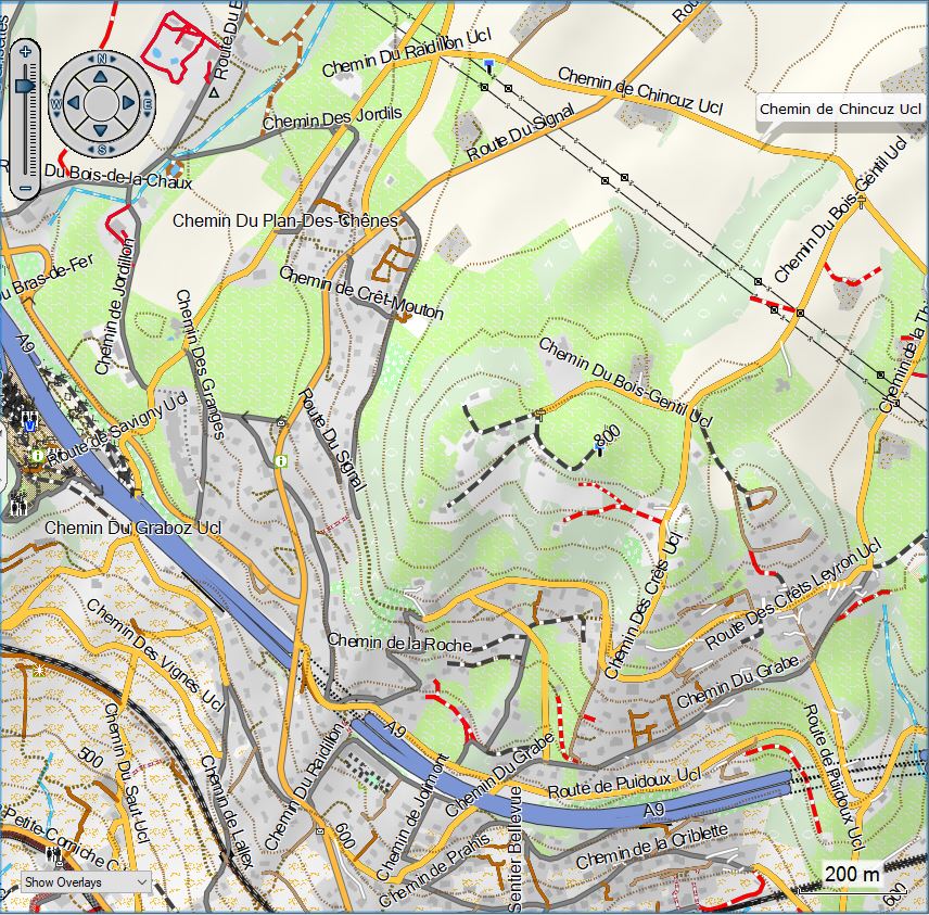
Some Screenshots showing the difference - in Lausanne:
vs the old wide legacy layout:
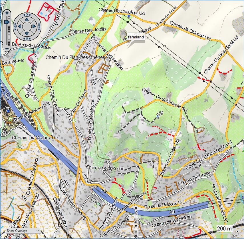
Testing layouts on Edge 1040/Edge Explore 2 - and some general info about the new Edge Generation with using the OpenMTBMaps or VeloMaps
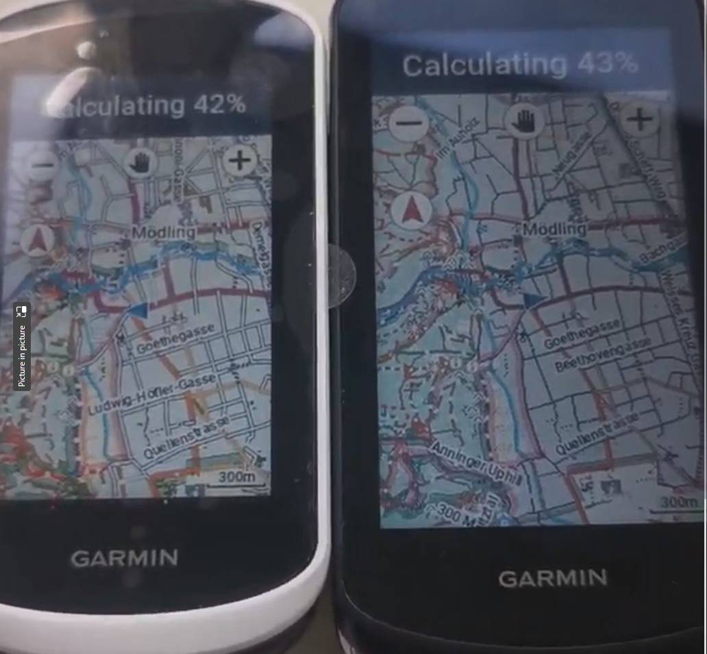
Oh yeah - what about the new Edge devices? Well the Edge Explore 2 and the edge 1040 have the identical processor/chipset. If you calculate a route - it will be in identical speed and the route will be identical too. As the display on the edge explore 2 is smaller - pannign the map around is actually a tiny bit faster. While the edge 1040 costs around 500€ right now - the Edge Explore costs around 230€ - less than half price. Feature wise it's mainly some training features missing. I still sent back the explore 2 because of the following reasons:
The battery life on the explore 2 is good - but not great. You get around 12-20 hours of use from it (depending on backlight intensity). The battery simply is way smaller than on the edge 1040. The Explore 2 misses a ambient light sensor - so you basically have to put the backlight to 80% permanently. Actually at 100% it is a tiny bit lighter compared to the edge 1040 - but the difference is hard to notice. I gues the technology is identical. The 1040 of course has .5 inches bigger display. It has twice the amount of memory 32GB vs 16GB. I think 16GB is enough for anyone except if you also use it to stream music to your headphones via Bluetooth.
The edge 1040 has an electromagentic compass - while the Edge 2 is missing a compass, which only matters if you're not moving and turning around. The GPS reception on the edge 1040 is better - if you use multiband GPS. However that consumes more battery (but then the edge 1040 has crazy long battery life - you get several days of riding easily - maybe a week.).
The original Garmin Edge was really crippled, the edge 2 is not. The differences to the 1040 really are tiny. Do not get the Solar Edge 1040 because the screen is a bit harder to read - and battery life is plenty anyhow on the normal 1040. I returned the Edge Explore 2 before I got the firmware update - I'm not sure if it has the POI search fixed already or not (I am sure it has on the beta firmware 6.x). As the software is (besides the missing features) identical to the 1040, it will surely be introduced too soon or already has been.
There are some other missing features (like Stamina, unlimited profiles instead of 3, Di2/Ant+ gear shifting,Strava live segments, structured workouts, battery connectors on the mount) all don't matter if you don't use them.
The choice of Oregon 600/700 vs the new edge devices is still hard. For hiking I got really annoyed that the edge devices have no quick button to lock the screen. Long pressing a button then locking the screen is quite tedious. During strong rain the Oregon is much easier to use. Autorouting is different but about same quality and speed and maximum distance. Of course the Oregon is missing all the training functionality. POI search is better on Oregon. Following a track is much better on edge - following a route a bit better because it now also shows arrows - so if you plan a route that forms say an 8, it is now much easier to see which way to follow (previously needed to look on the street name). Visibility of display is different - on the Oregon you need the backlight much less - but then battery life on Edge is good enough to just keep it on all the time.
A bit problematic is that Oregon is increasing in price since many years and has not seen any substrantial updates. And it's much bigger, you need Mini-USB cable and carry a battery charger while traveling.
As for other Garmin devices - stay away from etrex series - the etrex touch series is real junk IMHO - it was a huge downgrade vs the etrex 30 (slower, hard to use, missing features, buggy) while having way worse battery life than older etrex devices - even worse than Oregon 600 albeit much smaller screen. I never saw a reason for the bulky GPSMaps 60,62,64,66 series. For hiking I therefore still like my Oregon 600, on a mountainbike/road bike I rather use the new Edge 1040. And yeah finally USB-C on the new edge devices is really good.
List of other changes to the maps:
- The morocco english language maps had some bugs. Corrected it. This was as I overlooked that Morocco uses three scipts (latin, Berber and Arabic) which had caused a mess.
- highway=disused:path/footway/track with mtb:scale/mtb:scale:uphill would still show the mtb:scale ratings without the way.
- For highway=residential/service bridges were shown before the actual highway when zooming in.
- For highway=primary, secondary, tertiary now street labels are shown at resolution 23 too. This required adding some new line types to the .typ-files. Also in that process found out that for the VeloMap on some devices very difficult trails were not shown at all. Corrected this too.
- Sometimes (industrial) railways shown a bit too early when zooming in.

Recent Comments