 Le mappe sono compatibili con Tutti i più recenti Garmin PNAs con schermo a colori (per es. Legend/Vista HCx e Cx, 60/76CSx, Oregon, Colorado,Edge 705, Nuvi, Streetmap). Le mappe funzionano anche sugli smartwatch Garmin con schermo a colori. Tuttavia alcuni colori non sono ottimali sui display a 16 colori. Alcuni orologi hanno display a 64 colori e sono più adatti.
Compatibilità - Standard (Unicode) vs Non Unicode (non può autenticare le mappe / non può sbloccare le mappe)
Alcune mappe sono in Unicode di default - per essere in grado di visualizzare diversi alfabeti in una mappa - per esempio cirillico e latino. Senza Unicode, solo il cirillico o il latino possono essere visualizzati (mappe non-Unicode). Tuttavia, Garmin ha disattivato l'uso delle mappe Unicode gratuite nel corso di un'errata protezione della copia nei dispositivi GPS che sono stati introdotti di recente dal 2016. I paesi dove si usa solo il latino - non sono disponibili in Unicode - quindi la Germania è sempre latin1 (Non Unicode) - ma la mappa dell'Europa è disponibile sia in Unicode che in Non Unicode.
In generale basta scaricare le mappe dalla prima scheda "VeloMap" - sono in unicode se utile. Se si ottiene il messaggio - "non può autenticare le mappe" o "non può sbloccare le mappe", e si dispone di uno dei seguenti dispositivi:
Tutti i dispositivi Garmin presentati 2016 o più recenti
Edge 1000
Epix
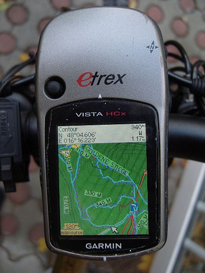
Etrex 20x / 30x (non "etrex 30")
Etrex Touch 25/35
GPS Maps serie 64
Montana 610, 680
Oregon 700,750
Alcuni dispositivi Nuvi recenti - così come alcuni dispositivi super vecchi che non supportano Unicode. (Per esempio Garmin Vista C, GPS Maps 60 C)
dovrai invece scaricare la versione "non unicode" della mappa. Quindi prendete la mappa dalla scheda "non unicode OpenMTBMap o VeloMap" invece. Solo le mappe delle regioni in cui sono usati diversi script - sono in unicode. Se il latino è lo script predominante - allora ovviamente non viene offerta nessuna mappa in unicode. Se il tuo dispositivo può visualizzare le mappe in Unicode - allora ovviamente prendi la versione standard - cioè Unicode. Le mappe non Unicode richiedono la registrazione per essere scaricate.
Schede SD
Questo non riguarda le mappe, ma in generale le unità Garmin dotate di una scheda microSD accettano solo schede SDHC - le schede SDXC non funzionano. La dimensione massima è di 32 GB e la scheda deve essere formattata con FAT32 (non exFAT). Fate attenzione alle schede da 32 GB che sono disponibili sia come SDHC che come SDXC. Le schede da 16 GB o più piccole sono sempre SDHC.
Garmin Edge x30 o più recente
Garmin ha introdotto una modalità ad alto contrasto completamente rotta - che sbianca i colori delle mappe. O disabiliti la modalità ad alto contrasto nella sezione visibilità delle mappe. Oppure cancella il file \Garmin\MapThemes\Mountain.kmtf (a volte chiamato anche \Garmin\MapThemes\Mountains.kmtf ) (fai un back up se pensi di voler mai usare quella modalità. Dall'ultimo firmware di luglio 2021 è necessario abilitare la modalità classica -
Profili attività, selezionare un profilo e selezionare Navigazione > Mappa > Tema mappa.
Classico: Questo mostra le OpenMTBMaps / VeloMaps come previsto, tuttavia i POI sono ora mostrati dal profilo Edge.
Alto contrasto: Completa cazzata da parte di Garmin - perché non sono in grado di rendere le loro mappe ad alto contrasto in primo luogo.
Mountain Biking: Fregatura completa da parte di Garmin - perché non sono in grado di rendere le loro mappe ad alto contrasto in primo luogo.
Garmin Basecamp - Perfettamente compatibile a partire dalla versione 3.
Garmin Mapsource 6.16.3 o più recente (PC/Wine/Mac basati su Windows) Mapsource compatibile - Raccomando di usare la 6.16.3. Se non avete ancora installato Mapsource - ecco come fare: https://openmtbmap.org/tutorials/install-mapsource/ Attenzione. Le versioni di Mapsource precedenti alla 6.16.1 non mostrano più tutte le strade e le vie, quindi non usatele con le OpenMTBMaps. Notate anche che Mapsource non mostra le curve di livello allo stesso tempo delle mappe (Basecamp invece lo fa).
Qlandkarte GT (dalla versione 1.0) - Cross Platform www.qlandkarte.org - nessun supporto di autorouting però. Viene fornito con la maggior parte delle distribuzioni Linux, sono disponibili i binari per Windows, altre piattaforme devono essere compilate. Meglio usare l'ultima versione. Ci sono costanti miglioramenti.
Il successore di Qlandkarte GT - Qmapshack funziona con le mappe in formato gmapsupp.img.
Android Il supporto limitato esiste su Oruxmaps ( Instructiozone: https://gravelmaps.de/android-using-garmin-maps-in-img-format/ ) e Locus Maps ( gmapsupp.img into Locus/mapsVector Verzeichnis schieben or Locus/mapsVector/openmtbmap_it.Img). Nota però che queste applicazioni possono solo visualizzare le mappe. Non è supportata la ricerca o l'autorouting utilizzando le mappe. Inoltre è meglio disattivare le etichette dei nomi delle strade - in quanto ingombrano la visualizzazione delle mappe. Altrimenti la visualizzazione delle mappe funziona abbastanza bene.
iOS: Non esistono app compatibili AFAIK.
Incompatibilità: Iphone, IQue 3600 (e altri?), vecchi palmari Garmin senza schermo a colori e scheda (micro)SD. Qualsiasi altro programma o PNA che non supporta i file .TYP. (come TTQV, Compegps,....)

Welche Koordianatensysteme werden empfohlen?
Danke für eure Antwort…
Das ist egal, wenn du wirklich noch wo Koordinaten abliest dann Stelle Basecamp auf das System ein.
Hallo,
ich habe die Karten unter Android in Locus Map Classic eingebunden. Die Karten habe ich wie beschrieben mit Mkgmap erstellt. Ich habe verschiedene Layouts probiert, allerdings zwei Probleme mit der Darstellung (siehe Screenshot):
1) Es werden sehr viele Straßennamen angezeigt, auch bei geringem Zoom (z.B. 30km). Laut Beschreibung kann man die Straßennamen Labels ausschalten. Wie? Geht das in Locus Map (habe keine Einstellungsmöglichkeit gefunden) oder bei der mkmap-Erstellung am Rechner?
2) Manche Bereiche auf der Karte werden mit einem rosa/violetten Hintergrund dargestellt.
Vielen Dank!
Andreas
straßennamen labels kann man in Locus abschalten, oder früher konnte man es – ich habe s schon lange nicht mehr genutzt.
2. – keine Ahnung, so noch nicht gesehen.
“Android Limited support exist on Oruxmaps (better than Locus – Instructions here: https://gravelmaps.de/android-using-garmin-maps-in-img-format/ ) and Locus Maps (place the gmapsupp.img maps into Locus/mapsVector directory (or any subdirectory here like Locus/mapsVector/openmtbmap_uk.img) . Note however that those apps can only display the maps. No search or autorouting using the maps is supported. Also you better swtich streetname labels off – as they will clutter the map display. Otherwise displaying the maps works pretty well.”
1. running Android 13 on Pixel devices – the maps loaded fine on Locus, thanks. Based on this comment, I paid for Orux Maps but cannot load the maps. The instructions at the gravelmaps link don’t seem to work & the help link in that page is broken.
2. do you mean switch street name labels off in the app or before transferring the .img file?
Thanks!
2. It does not matter if before or after – it’s just that the streetnames used to clutter up the map because they were far too many , and it did not respect the settings from the .typ files.
1. Maybe it was dropped in recent version(s)? The implementation of Oruxmaps and Locusmaps was more or less identical anyhow. I only tried Locusmaps myself – never Oruxmaps but some years ago they used the same implementation as Locus.
OK, thx for the quick reply. Maybe you’d like to remove the “better than Locus” from the page, since Locus is still free(if ad-supported) & Orux costs – even if only €4. Might save other users wasting their money.
I’ll keep trying with Orux & update here if I fix it.
Keep up the great work, Steve
Please report back if you can get it to work or not – then I will update the guide and cross out Oruxmpas if it’s really not working anymore.
OK, thanks for patience. It’s now working.
The file location has changed in the latest version (9) – it’s now a subdirectory of files – see below.
Orux maps – map download 31/8/2022
Google Pixel 4a, Android 13
Orux maps version 9.0.4, paid (€4)
Corrected URL for manuals: available in Spanish, English, Italian & French. (I’m using the English version)
https://www.oruxmaps.com/cs/en/manual
Map files location
1. Pixel doesn’t have an SD card slot so I’ve skipped the bit about changing the default file location.
2. This is the correct path when the Pixel is plugged into File Explorer on Windows:
This PC\Pixel 4a\Internal shared storage\Android\data\com.orux.oruxmapsDonate\files\oruxmaps\mapfiles
3. Copied the Germany premium gmapsupp.img file (same version as I downloaded for my Garmin eTrex) to this location.
It’s a good idea to rename it, otherwise you just see gmapsupp.img, e.g. to OMTB_Germany
4. Click the update icon (highlighted – see attachment) …. & success!
I added Austria just to check, no problems.
Steve
Can you see any advantage over Locus Maps? I guess they still use the identical vey old never updated map engine?
Visually it’s more appealing – the app looks more up-to-date .. & for €4, you get rid of the ads.
Locus Premium is €10 a year now.
Having loaded the maps, I’m going for a spin .. so will let you know 🙂
First impressions on the move very positive. I’m going to stick with it for a while. I’ll update this thread in a few weeks
Hallo Felix,
ich hatte Deine Karten bisher auf einem Oregon 600 installiert. Dort war die Darstellung prima. Seit zwei Tagen habe ich nun ein Edge 1030+ und dort bei der Installation Clasic ausgewählt. Die Karten werden auch angezeigt, jedoch alle Waldwege nur als ganz dünne Linie und alle in der gleichen Farbe angezeigt, sie lassen sich kaum von Höhenlinien unterscheiden.
Deine Anweisungen bezüglich der Edge Modelle habe ich soweit befolgt, meine ich, oder habe ich etwas übersehen?
Anbei ein Screenshot meiner Darstellung.
Das ist eindeutig nicht mein Layout – also entweder etwas falsch gemacht bezüglich Edge, oder irgendwie gar kein .typfile in Verwendung. Eher ersteres.
Hab die Karten alle nochmal neu installiert, diesmal mit ‚wide‘, jetzt sieht es besser aus. Vielleicht etwas wenig Kontrast, meinst du ich sollte die zweite ‚wide‘ Option probieren?
es sollte ziemlich ident zu Basecamp ausschauen – sonst hast du ein Problem dass das Theme benutzt wird was alles zerstört. Wide bzw Wide Legacy ist nur Unterschied bezüglich Straßenfarben deutsch klassisch vs google maps.
Hier nochmal ein Screenshot wie es jetzt aussieht. In Basecamp ist alles deutlich kräftiger, am Oregon war es auch kräftiger.
Die Muster und Farben müssen am Edge identisch sein bis auf Kontrast. Ansonsten ist das kmtf aktiv. So wie her scheint korrekt. Die einzige echte Ausnahme sind Fenix Uhren, bzw forerunner 945/955 mit 64 Farb Display welches dazu noch extrem vom Blickwinkel/Sonne abhängig ist.
Danke Dir. Wünsch dir noch schöne Pfingsten.
Ok aber ich muss sagen am Computer sieht der screenshot jetzt besser aus als auf meinem Edge. So wäre es perfekt 🙂
Hello,
I would like to use non-unicode maps (for an Oegon 700 I plan to buy) and build the maps on my Linux system since I do not have a Windows computer. Is it possible to compile your non-unicode maps from .exe to .img using https://github.com/btittelbach/openmtbmap_openVeloMap_linux
Can you pass me any example non-unicode map to test it?
Best regards,
Bernhard
The austria map is always non unicode (as are all other maps that are from countries using latin alphabet). But why don’t you just download the gmapsupp.img format maps? You do not need this script then. there is a bash script attached to change the .typ file.
Thanks a lot for your reply, dear extremecarver, telling me that downloads of gmapsupp.img are supported directly.
Tag
Ist das etrex 32x mit den Karten kompatibel? GGfs. unter welchen Bedingungen?
Danke im Voraus und Gruß
ja so wie alle neuen Geräte – halt keine Unicode Karten. Aber es gibt ja alle Länder in Non Unicode. Etrex 30 Touch ist schrottlahm, und Akku auch nicht gut – mein Oregon 600 läuft deutlich länger trotz größerem Display. Keine Ahnung wie das 32x ist – aber die etrex Reihe war in den letzten Jahren eher nicht zu empfehlen.
Thanks a lot for your reply, dear extremecarver, telling me that downloads of gmapsupp.img are supported directly.
Sorry, I posted the comment above in the wrong thread
you should also be able to use Basecamp/MapInstall via WineHD if you wanna use the maps on desktop. Alternatively the gmapsupp.img downloads in Qmapshack (but I cannot offer maps >4GB as gmapsupp.img download – as garmin GPS devices use FAT32). Meaning no possibility to use europe or asia continent map that way.
Qmapshack is my preferred application; I never used Basecamp.
Do you know why Qmapshack local routing (with intstalled database) does not like some tracks and drives around even if I put some routing points on them. Even in pedestrian routing mode. Looks to me like a bug; do you know how to work around?
I thought qmapshack is only using routing via online service, Are you sure it can route with garmin maps? Is there any routing on the legend map (cause that would not work online, that is fictious data).
In my Linux Qmapshack application the is a menu item “Werkzeug”->”Routino Datenbank erstellen”. Having installed that you can interactively route. I think it does not base on routing of the .img used since you have to download extra OSM data from http://download.geofabrik.de/
You *must* try it, because it is able to route distances of many kilometers in fractions of a second. Sou you even experience routing while you move a waypoint with the mouse.
yes that has nothing to do with my maps. Actually that garmin is routing so slow – is anyhow strange. GPSMapedit can route super speedy with fantastic results. Garmin is just using a really bad algorythm.
gpsmapedit routes on garmin maps (limited to the size of map you can load in gpsmapedit). It’s the only non garmin program routing on garmin maps to my knowledge.
Hallo,
gibt es hier irgendwo Empfehlungen zu den Navis?
Ich finde den edge explore interessant, da er für mich das notwendige hat und einen großen Bildschirm bei günstigem Preis. Die Kopplung it Kommot finde ich auch sehr angenehm.
Allerdings steht im Produktvergleich:
Möglichkeit, Karten hinzuzufügen – kein Haken
Kann ich auf dem Gerät mtbmaps und VeloMaps installieren und zum Routen nutzen?
Grüße
Bernd
Edge Explore ist kein Problem – ist quasi ein um viele Trainingsfunktionen gestutztes Edge 1030. Wenn dir die Batterlaufzeit ausreicht – dann ist er gut. Sonst am besten Oregon 7xx Serie. Die aktuellen etrex sind nicht so sehr gelungen.
Ich habe jetzt den Edge Explore, der erste Versuch war eine Enttäuschung. Ich habe alle Karten bis auf mtbmaps deaktiviert.
Meine Einstellungen: Routing-Modus: Mountainbiken, Berechnungsmethode: Distanz minimieren, Vermeidung: Nur Mautstraßen.
Automatisch erstellte Rundtouren ca.40km: Es wird viel entlang der Straße geroutet und die schönen kleinen Wege, die ich nehmen würde, werden nicht genutzt.
Ich habe dann mit BaseCamp versucht eine Route zu erstellen. Das war noch schlimmer. Hier wurden fast nur Straßen verwendet und ich musste direkt auf die Waldwege zwingen. Dabei hatte ich alle Einstellungen wie hier empfohlen gemacht.
Früher hat das Mal gut funktioniert und ich habe schöne Trails und Waldwege vorgeschlagen bekommen.
Unter Basecamp dirt Bike geht eigentlich ganz gut – Oder geht das auch nicht mehr gut. Garmin ändert da leider ständig irgendwas rum – und es wird nicht besser sondern nur schlechter.
Generell – zu große distanzen von einem Punkt zum nächsten sind nachteilig…
Hello
Could you tell me if the GARMIN Montana 610 and 680 GPS are compatible with the old .IMG cards
thank you for your reply
Rene66
what do you mean with old .img cards? The montana is only compatible with non-unicode maps – but yes you can download all the non-unicode gmapsupp.img maps, un-extract them, and use them straight away on Montana.
Hi, how can I make maps compatible with Twonav’s Land software?
You can’t. For twonav you can only use their own twonav vector maps – or raster/image maps from scanned sources and so on. TwoNav and vector maps is pretty problematic. They are strong when it comes to various for of raster (“scanned”) maps.
I downloaded the US West group and during install I receive a warning from Webroot regarding a Trojan in the Change Layout execution file. The map still installs in Base Camp, but I cannot change the layout. I cannot install again as Webroot removes the execution file from the computer. If I completely download the map package again, I can install it and use the maps again, but receive the same warning before Webroot deletes the execution file. I’ve attached a screen shot of the warning in the scan log.
well false positive. The change layout tool needs to write into the Windows registry – likely the antivirus doesn’t like it. Check the change_layout for my digital signature. If the signature is okay – the .exe is fine. If signature is missing – tell me. Very rarely the signature is not created because of missing connection 5 times. Then the antivirus would be kinda in the right (still wrong but okay to assume so).
Thank you for the quick reply! Looks like signature is there and valid through 07/21/2022. I was able to go into Webroot and allow it to install. Once I did that, all is good and I can change the layout with the execution file now.
Hallo, wegen OS Upgrade werde ich gezwungen BaseCamp auf 4.8.6 zu updaten. Compatibility??
Danke!! Martin
die aktuellen Versionen sind okay. Kein Problem mit dem Upgrade. Unbenutzbar wegen kaputten MapInstall waren am Mac nur die 4.7.x Versionen (bzw 4.7.1 unter Windows)
Das BaseCamp Upgrade 4.8.11 am iMac macOS 11.1 durchgeführt – die neue Vers. hat das BackUp der älteren Version nicht genommen. Alle gefahrene Tracks von Sept. 2019 waren verloren. No chance! Die “legacy” Vers. 4.7 lässt sich nicht installieren.
Eine Lösung, die nicht jeder machen kann: aus dem Keller einen älteren Mac geholt (macOS 10.11.6), BaseCamp 4.6.3 installiert, mit der BackUp Datei gefuttert, alles wieder da. Jetzt werde ich meine Tracks als GPX auf ein memory stick sichern und in das neue BaseCamp importieren.
du hättest nicht das Backup gebraucht – sondern einfach nur den Inhalt vom Speicherort in den Speicherort von 4.8 rüberschieben. Evtl zuerst die 4.8.0 downloaden und installieren – und von der Weg dann das Upgrade auf 4.8.11 machen. Ich glaube am Format hat sich nichts geändert – es wurde einfach nur der Speicherort der Datenbank geändert. Aber ich mag mich täuschen. Bei 4.7 war es auf jeden Fall so. Ob es für 4.8 dann Änderungen gab weiß ich nicht. 4.6 auf 4.8.0 mit Speicherort ändern ging auf jeden Fall AFAIK
Ich werde, fürs Wandern/MTB demnächst auf ein Outdoor-Smartphone (Android) umsteigen.
In welchen Apps sind Deine Karten nutzbar?
Es geht mir nicht um eine vollständige Routing-Funktion, sondern wandern/MTB-fahren nach “Sicht”.
Welche Kartenform wären dann nutzbar? Ich nehme an alle, außer die Premium, da die ja, wenn ich das richtig verstanden habe, direkt für Garmin vorgesehen sind.
Danke vorab!
Gruß
Bernd
Ganz eingeschränkt mit Locusmaps/Oruxmaps (Anzeige von gmapsupp.img ohne Straßennamen Labels). Im Prinzip macht es aber wenig Sinn. Karten gehen alle – eben mit den Einschränkungen.
Hallo,
ich interessiere mich für das Garmin Montana 700. Sind deine Karten mit diesem Gerät kompatibel?
Vielen Dank!
Andreas
Ja (die Non Unicode Verion der Karten – Unicode Versionen gehen nicht).