[:en]
Some of you may have noticed - that the European country maps since last week now include a DEM - digital elevation model in addition to the contourlines. Todays and Tomorrows map update will now bring DEM to all maps - this has quite a few advantages. E.g. altitude profiles for tracks, a more plastic and easier to understand topography overview in Basecamp on desktop - and the quite useful 3D view in Basecamp (make sure to set elevation exaggeration in Options --> Display --> scroll down to 3D to 0% - the default 100% is really too much inside the Alps.
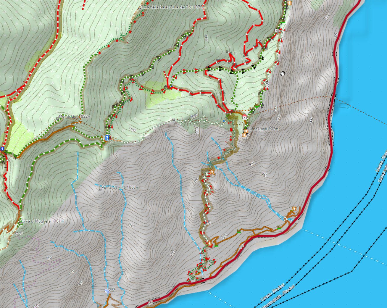
above the Lago die Garda and some of it's nicest trails - notice the DEM shading....
On your Garmin GPS device I have so far not enabled DEM (if you set show DEM to auto it will not show) - I'm working on adding this a couple of weeks later - but as it is only useful when zoomed out very far (if you're zoomed in close it only makes the map darker - and the GPS device screen is too small to properly see the altitude profile properly if zoomed in close). I may add in future DEM shading for devices for zoom levels 5km or 10km to 30km - this helps understanding the topography a bit - however even though I looked at optimizing this as well as possible - it still slows down the map drawing when panning the map around quite substantially (it's not too bad as first the map is drawn - then in a second step it's shaded). I will need to do some further tests on this before it will be released however.
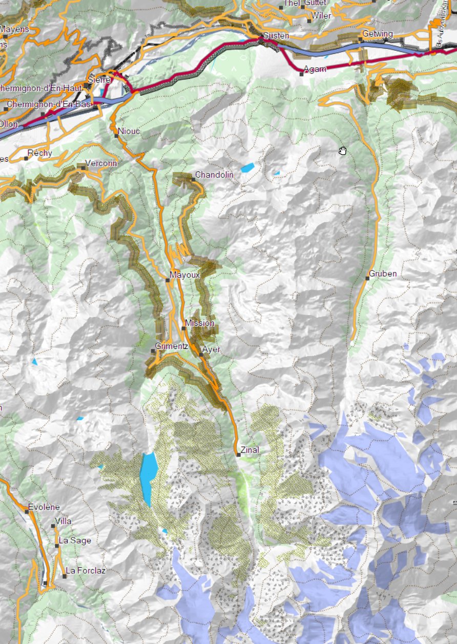
For maps where the contourlines are not integrated but as a separate download - this may cause some chaos tomorrow as the old contourlines are replaced on server as the openmtbmap is created on server - but it may take some time to be downloadable on the FTP server. Especially for the VeloMaps tomorrow there will be many countries where the new contourlines are already online, but the map is not yet. European maps are not affected here however - and the OSx OpenMTBMaps are also not affected. However make sure especially on OSx that you do not reuse your old contourlines if the map is compiled Yesterday or newer! On windows the new installer will throw an error if you provide the old contourlines however the old installer (if map is older than yesterday) will happily unpack the new contourlines and the map will be broken (no contourlines visible - and when you try to send it to device it will fail).
As for some countries the contourlines including DEM became too big (5 countries overall, in Europe only Norway) those countries now have contourlines as external download. I'm sorry that for Norway last week the contourlines v3 download was not online until 2 days ago (so 4 days after the map update).
Above Picture shows the Nordkette in Innsbruck with 100% 3D exaggeration - notice that on the backside - you cannot see much anymore. Therefore I advise to stay away from the exaggeration for planning - it's nice for looking at it though.
The next update of the Europe map (mid next week) will then also see DEM - it will be the last map to be changed to include DEM though.
In some places when routing along over the last 1-3 years the openmtbmaps and velomaps did cause crashes (fine if not using autorouting) - this was due to OSM mapping errors - in combination of my maps being aggressively tuned for best routing for MTBs and bicycles - most of these are now solved in software - and not problematic anymore (especially roundabouts were problematic). There are still a very few places where this can happen (maybe 40 in Germany, 50 in Italy, 10 in Austria and so on) - and I hope that at least 90% of those remaining will also be solved soon. The problem is always related to people drawing roads on top of each other in OSM without noticing their mistake - if then at least one of the overlaying incorrect ways is part of a hiking, bicycle or MTB relation (route) this likely caused problems. Also some super detailed areas where people drew roads shorter than 5m into OSM were problematic (this is 99% solved now).
Also last week only, some software misconfiguration caused some maps not to be digitally signed - and virus scanners running havoc - this is fixed in todays map update too - Sorry for the glitch it happened as I cleaned up the OS to dig out HDD space.
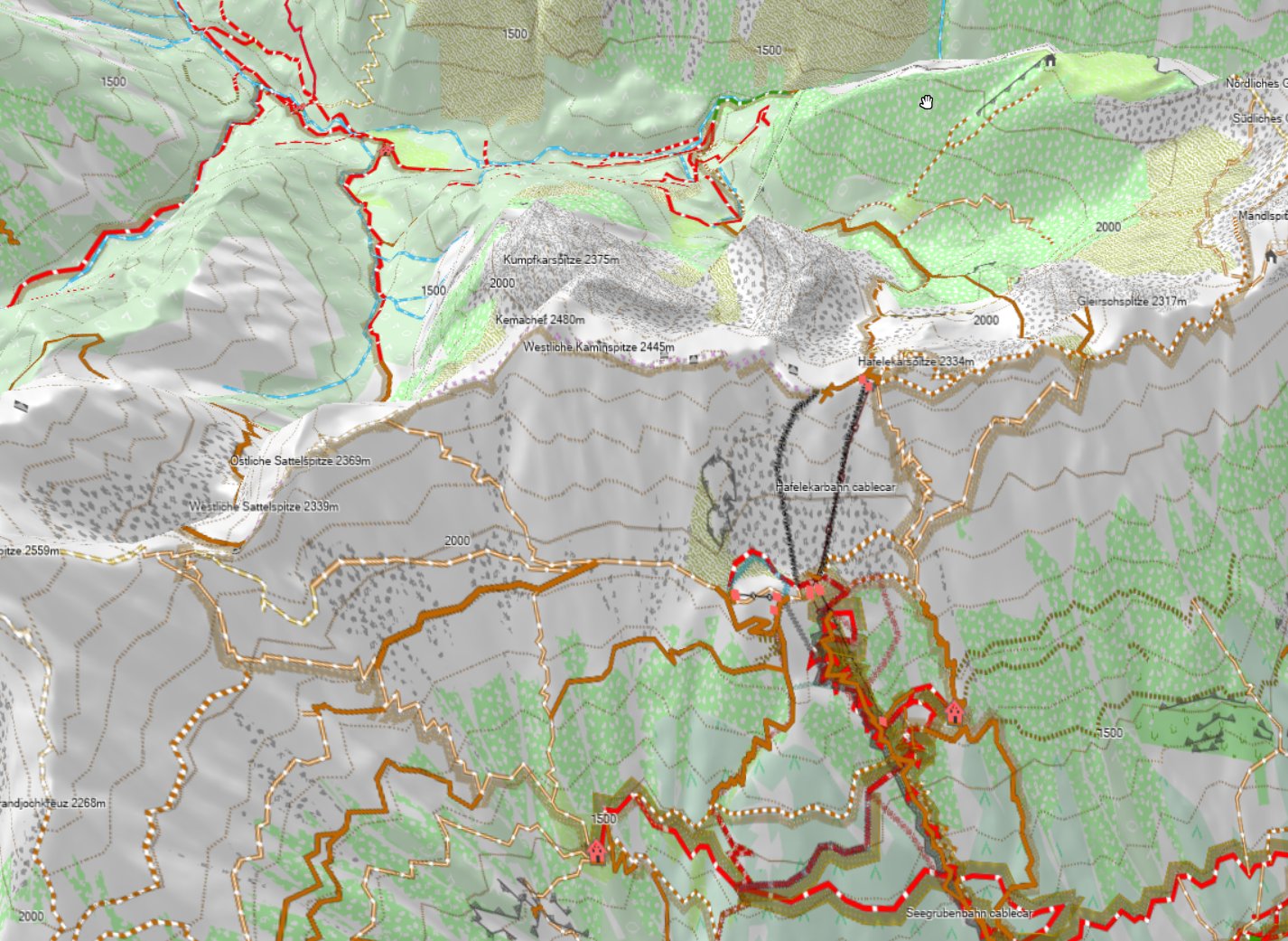
Raxseilbahn in Lower Austria - like this with 0% altitude exaggeration the 3D view is pretty nice for planning!
[:de]
Einigen ist es vielleicht schon aufgefallen - seit letzter Woche haben fast alle europäischen Karten nicht nur Höhenlinien - sondern auch ein DEM - also ein Digitales Höhenmodell wenn die Höhenlinien in die Karte integriert werden.
Mit dem heutigen/morgigem Kartenupdate wird dies auf alle Karten weltweit ausgeweitet. Dies hat einige Vorteile - so sieht man in Basecamp nun auch eine Höhenschattierung - welche bei der Orientierung beim planen visuell hilft. Auch kann man nun mit 3D Karten planen (was allerdings IMHO nur Sinn macht - wenn man vorher in Optionen --> Ansicht --> ganz runterscrollen zu 3D Überhöhung - 0% einstellt - bzw endlich gibt es auch bei Tracks ein Höhenprofil.
Das Höhenprofil bei Routen ist auch detaillierter - ABER hat jetzt meist genauso wie etwa bei Garmins eigenen Karten auch das Problem dass der Höhenunterschied eher überbewertet wird - 10-20% sollte man da in etwa abziehen dann passt es ganz gut.
Auch auf Garmin GPS Geräten ist das Höhenprofil nun deutlich nutzbarer.
Hier etwa mein Lieblingstrail vorne runter zum Gardasee - man erkennt gut die Schattierung und Steilheit.
Auf Garmin GPS Geräten wird derzeit die Karte (noch) nicht plastisch angezeigt. Ich bin hier noch etwas am experimentieren ob man dies sinnvoll hinbekommt. Denn Sinn macht es nur wenn man recht weit rauszoomt - sonst verdunkelt es nur die Karte ohne dass man Zusatzinfos bekommt - und es bremst die meisten Geräte doch recht ordentlich aus.
Wahrscheinlich kommen hier dann noch separate Karten für jene die auch am GPS Gerät eine Schattierung haben möchten - aber NUR im Bereich 5 oder 10 bis 30km Zoommaaßstab. Dass Problem dabei ist noch halbwegs Details zu sehen ohne das Gerät komplett auszubremsen beim Karte verschieben. Da probiere ich derzeit noch einiges durch und werde nächste oder übernächste Woche entscheiden ob es sich lohnt oder nicht.
Der Server lädt die neuen v3 Höhenlinien nach erstellen der Karte automatisch hoch - da die Karten aber teils auf dem FTP Server liegen der nur einmal pro Tag gespiegelt wird, kann es Morgen - gerade bei der VeloMap zur Situation kommen dass schon die neuen Höhenlinien online sind, aber noch die alten Karten. Morgen wird es also etwas chaotisch diesbezüglich. Dieses Problem betrifft aber NUR Karten wo die Höhenlinien separat sind, und betrifft vor allem Windows User. Für OSx wird es primär bei der VeloMap die zu neuen Höhenlinien geben.
In Europa hat nur Norwegen externe Höhenlinien (gut dazu noch Türkei/Ukraine/Russland) - sonst sind die Höhenlinien eh in den Karten integriert und damit immer passend.
Der Installer unter Windows überprüft automatisch ob die Höhenlinien neu sind, und gibt wenn nicht eine Fehlermeldung. Aber Achtung - die alten Installer installieren die neuen Höhenlinien ohne nachfragen/Problemmeldung nur funktionieren diese dann nicht bzw wird sich die Karte nicht senden lassen.
Sorry auch nochmal dass für Norwegen 4 Tage lang gar keine Höhenlinien downloadbar waren (Sontag bis Mittwoch).
Hier ein Beispielscreenshot vom 3D Modus in Innsbruck mit 100% Überhöhung - man sieht gut dass am Nordhang der Nordkette die Karte deutlich zu gestaucht erscheint - sprich man erkennt nicht mehr viel. Daher 0% außer für Screenshots wo es um die Bervorderseite geht...
Die Europakarte werde ich Mitte nächster Woche updaten, und dann also auch mit neuen Höhenlinien mit DEM - wenn alles gut klappt.
In den letzten 1-3 Jahren gab es ein paar Kartenstellen wo die OpenMTBMaps oder VeloMaps beim autorouting abgestürzt sind - der Fehler liegt an einer Kombination aus dem aggressiven versuchen Fahrrad/MTB freundliche Wege zu wählen und Datenfehlern in OSM (zund zwar genauer - dort wo fehlerweise mehrmals derselbe Weg übereinander eingetragen ist - am übelsten wenn auch noch beide Wege Teil einer MTB/FAhrad/Wanderroute sind.
Das Problem ist nun zu 95% gelöst - es verbleiben in DE etwa noch 20-30 Einzelne Stellen wo es noch zu abstürzen kommen kann - ich hoffe dass ich das in den nächsten Wochen auf 3-4 reduzieren kann. In Italien gibt es so Fehler etwas öfter. Dazu tritt es teils dort auf - wo extrem detailliert gemapped wurde - und Straßenstücke unter 5.4m Länge in OSM eingetragen sind - dies wird wohl leider weiter problematisch sein - ist aber auch sehr sehr selten.
Letzlich - letzte Woche beim Kartenupdate lief etwas bei den digitalen Signaturen schief - und viele Karten wurden nicht signiert - dass ist diese Woche wieder gelöst (verursacht durch aufräumen des OS wobei eine Library die wichtig ist wegfiel.)
Raxseilbahn in Niederösterreich - 3D Ansicht mit 0% Überhöhung - wie man sieht macht so die 3D Ansicht zum planen schon Sinn, es ist noch alles gut erkennbar (solange <50-60° steil) - und man erkennt recht gut die Steilheit.
[:it]
Some of you may have noticed - that the European country maps since last week now include a DEM - digital elevation model in addition to the contourlines. Todays and Tomorrows map update will now bring DEM to all maps - this has quite a few advantages. E.g. altitude profiles for tracks, a more plastic and easier to understand topography overview in Basecamp on desktop - and the quite useful 3D view in Basecamp (make sure to set elevation exaggeration in Options --> Display --> scroll down to 3D to 0% - the default 100% is really too much inside the Alps.
above the Lago die Garda and some of it's nicest trails - notice the DEM shading....
On your Garmin GPS device I have so far not enabled DEM (if you set show DEM to auto it will not show) - I'm working on adding this a couple of weeks later - but as it is only useful when zoomed out very far (if you're zoomed in close it only makes the map darker - and the GPS device screen is too small to properly see the altitude profile properly if zoomed in close). I may add in future DEM shading for devices for zoom levels 5km or 10km to 30km - this helps understanding the topography a bit - however even though I looked at optimizing this as well as possible - it still slows down the map drawing when panning the map around quite substantially (it's not too bad as first the map is drawn - then in a second step it's shaded). I will need to do some further tests on this before it will be released however.
For maps where the contourlines are not integrated but as a separate download - this may cause some chaos tomorrow as the old contourlines are replaced on server as the openmtbmap is created on server - but it may take some time to be downloadable on the FTP server. Especially for the VeloMaps tomorrow there will be many countries where the new contourlines are already online, but the map is not yet. European maps are not affected here however - and the OSx OpenMTBMaps are also not affected. However make sure especially on OSx that you do not reuse your old contourlines if the map is compiled Yesterday or newer! On windows the new installer will throw an error if you provide the old contourlines however the old installer (if map is older than yesterday) will happily unpack the new contourlines and the map will be broken (no contourlines visible - and when you try to send it to device it will fail).
As for some countries the contourlines including DEM became too big (5 countries overall, in Europe only Norway) those countries now have contourlines as external download. I'm sorry that for Norway last week the contourlines v3 download was not online until 2 days ago (so 4 days after the map update).
Above Picture shows the Nordkette in Innsbruck with 100% 3D exaggeration - notice that on the backside - you cannot see much anymore. Therefore I advise to stay away from the exaggeration for planning - it's nice for looking at it though.
The next update of the Europe map (mid next week) will then also see DEM - it will be the last map to be changed to include DEM though.
In some places when routing along over the last 1-3 years the openmtbmaps and velomaps did cause crashes (fine if not using autorouting) - this was due to OSM mapping errors - in combination of my maps being aggressively tuned for best routing for MTBs and bicycles - most of these are now solved in software - and not problematic anymore (especially roundabouts were problematic). There are still a very few places where this can happen (maybe 40 in Germany, 50 in Italy, 10 in Austria and so on) - and I hope that at least 90% of those remaining will also be solved soon. The problem is always related to people drawing roads on top of each other in OSM without noticing their mistake - if then at least one of the overlaying incorrect ways is part of a hiking, bicycle or MTB relation (route) this likely caused problems. Also some super detailed areas where people drew roads shorter than 5m into OSM were problematic (this is 99% solved now).
Also last week only, some software misconfiguration caused some maps not to be digitally signed - and virus scanners running havoc - this is fixed in todays map update too - Sorry for the glitch it happened as I cleaned up the OS to dig out HDD space.
Raxseilbahn in Lower Austria - like this with 0% altitude exaggeration the 3D view is pretty nice for planning!
[:es]
Some of you may have noticed - that the European country maps since last week now include a DEM - digital elevation model in addition to the contourlines. Todays and Tomorrows map update will now bring DEM to all maps - this has quite a few advantages. E.g. altitude profiles for tracks, a more plastic and easier to understand topography overview in Basecamp on desktop - and the quite useful 3D view in Basecamp (make sure to set elevation exaggeration in Options --> Display --> scroll down to 3D to 0% - the default 100% is really too much inside the Alps.
above the Lago die Garda and some of it's nicest trails - notice the DEM shading....
On your Garmin GPS device I have so far not enabled DEM (if you set show DEM to auto it will not show) - I'm working on adding this a couple of weeks later - but as it is only useful when zoomed out very far (if you're zoomed in close it only makes the map darker - and the GPS device screen is too small to properly see the altitude profile properly if zoomed in close). I may add in future DEM shading for devices for zoom levels 5km or 10km to 30km - this helps understanding the topography a bit - however even though I looked at optimizing this as well as possible - it still slows down the map drawing when panning the map around quite substantially (it's not too bad as first the map is drawn - then in a second step it's shaded). I will need to do some further tests on this before it will be released however.
For maps where the contourlines are not integrated but as a separate download - this may cause some chaos tomorrow as the old contourlines are replaced on server as the openmtbmap is created on server - but it may take some time to be downloadable on the FTP server. Especially for the VeloMaps tomorrow there will be many countries where the new contourlines are already online, but the map is not yet. European maps are not affected here however - and the OSx OpenMTBMaps are also not affected. However make sure especially on OSx that you do not reuse your old contourlines if the map is compiled Yesterday or newer! On windows the new installer will throw an error if you provide the old contourlines however the old installer (if map is older than yesterday) will happily unpack the new contourlines and the map will be broken (no contourlines visible - and when you try to send it to device it will fail).
As for some countries the contourlines including DEM became too big (5 countries overall, in Europe only Norway) those countries now have contourlines as external download. I'm sorry that for Norway last week the contourlines v3 download was not online until 2 days ago (so 4 days after the map update).
Above Picture shows the Nordkette in Innsbruck with 100% 3D exaggeration - notice that on the backside - you cannot see much anymore. Therefore I advise to stay away from the exaggeration for planning - it's nice for looking at it though.
The next update of the Europe map (mid next week) will then also see DEM - it will be the last map to be changed to include DEM though.
In some places when routing along over the last 1-3 years the openmtbmaps and velomaps did cause crashes (fine if not using autorouting) - this was due to OSM mapping errors - in combination of my maps being aggressively tuned for best routing for MTBs and bicycles - most of these are now solved in software - and not problematic anymore (especially roundabouts were problematic). There are still a very few places where this can happen (maybe 40 in Germany, 50 in Italy, 10 in Austria and so on) - and I hope that at least 90% of those remaining will also be solved soon. The problem is always related to people drawing roads on top of each other in OSM without noticing their mistake - if then at least one of the overlaying incorrect ways is part of a hiking, bicycle or MTB relation (route) this likely caused problems. Also some super detailed areas where people drew roads shorter than 5m into OSM were problematic (this is 99% solved now).
Also last week only, some software misconfiguration caused some maps not to be digitally signed - and virus scanners running havoc - this is fixed in todays map update too - Sorry for the glitch it happened as I cleaned up the OS to dig out HDD space.
Raxseilbahn in Lower Austria - like this with 0% altitude exaggeration the 3D view is pretty nice for planning!
[:en]Recent Comments [:de]Letzte Kommentare [:it]Commenti Recenti[:]