Some of you may have noticed - that the European country maps since last week now include a DEM - digital elevation model in addition to the contourlines. Todays and Tomorrows map update will now bring DEM to all maps - this has quite a few advantages. E.g. altitude profiles for tracks, a more plastic and easier to understand topography overview in Basecamp on desktop - and the quite useful 3D view in Basecamp (make sure to set elevation exaggeration in Options --> Display --> scroll down to 3D to 0% - the default 100% is really too much inside the Alps.
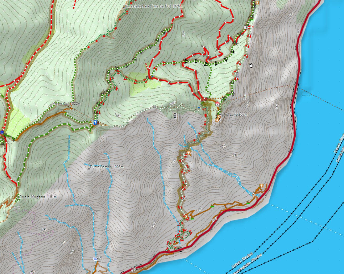
above the Lago die Garda and some of it's nicest trails - notice the DEM shading....
On your Garmin GPS device I have so far not enabled DEM (if you set show DEM to auto it will not show) - I'm working on adding this a couple of weeks later - but as it is only useful when zoomed out very far (if you're zoomed in close it only makes the map darker - and the GPS device screen is too small to properly see the altitude profile properly if zoomed in close). I may add in future DEM shading for devices for zoom levels 5km or 10km to 30km - this helps understanding the topography a bit - however even though I looked at optimizing this as well as possible - it still slows down the map drawing when panning the map around quite substantially (it's not too bad as first the map is drawn - then in a second step it's shaded). I will need to do some further tests on this before it will be released however.
For maps where the contourlines are not integrated but as a separate download - this may cause some chaos tomorrow as the old contourlines are replaced on server as the OpenMTBMap is created on server - but it may take some time to be downloadable on the FTP server. Especially for the VeloMaps tomorrow there will be many countries where the new contourlines are already online, but the map is not yet. European maps are not affected here however - and the OSx OpenMTBMaps are also not affected. However make sure especially on OSx that you do not reuse your old contourlines if the map is compiled Yesterday or newer! On windows the new installer will throw an error if you provide the old contourlines however the old installer (if map is older than yesterday) will happily unpack the new contourlines and the map will be broken (no contourlines visible - and when you try to send it to device it will fail).
As for some countries the contourlines including DEM became too big (5 countries overall, in Europe only Norway) those countries now have contourlines as external download. I'm sorry that for Norway last week the contourlines v3 download was not online until 2 days ago (so 4 days after the map update).
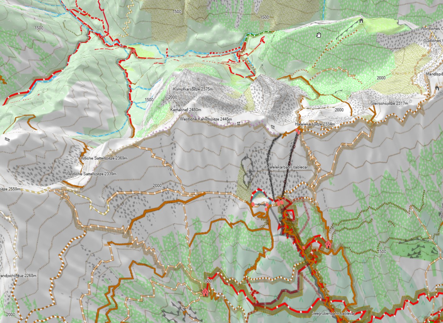
Above Picture shows the Nordkette in Innsbruck with 100% 3D exaggeration - notice that on the backside - you cannot see much anymore. Therefore I advise to stay away from the exaggeration for planning - it's nice for looking at it though.
The next update of the Europe map (mid next week) will then also see DEM - it will be the last map to be changed to include DEM though.
In some places when routing along over the last 1-3 years the OpenMTBMaps and VeloMaps did cause crashes (fine if not using autorouting) - this was due to OSM mapping errors - in combination of my maps being aggressively tuned for best routing for MTBs and bicycles - most of these are now solved in software - and not problematic anymore (especially roundabouts were problematic). There are still a very few places where this can happen (maybe 40 in Germany, 50 in Italy, 10 in Austria and so on) - and I hope that at least 90% of those remaining will also be solved soon. The problem is always related to people drawing roads on top of each other in OSM without noticing their mistake - if then at least one of the overlaying incorrect ways is part of a hiking, bicycle or MTB relation (route) this likely caused problems. Also some super detailed areas where people drew roads shorter than 5m into OSM were problematic (this is 99% solved now).
Also last week only, some software misconfiguration caused some maps not to be digitally signed - and virus scanners running havoc - this is fixed in todays map update too - Sorry for the glitch it happened as I cleaned up the OS to dig out HDD space.

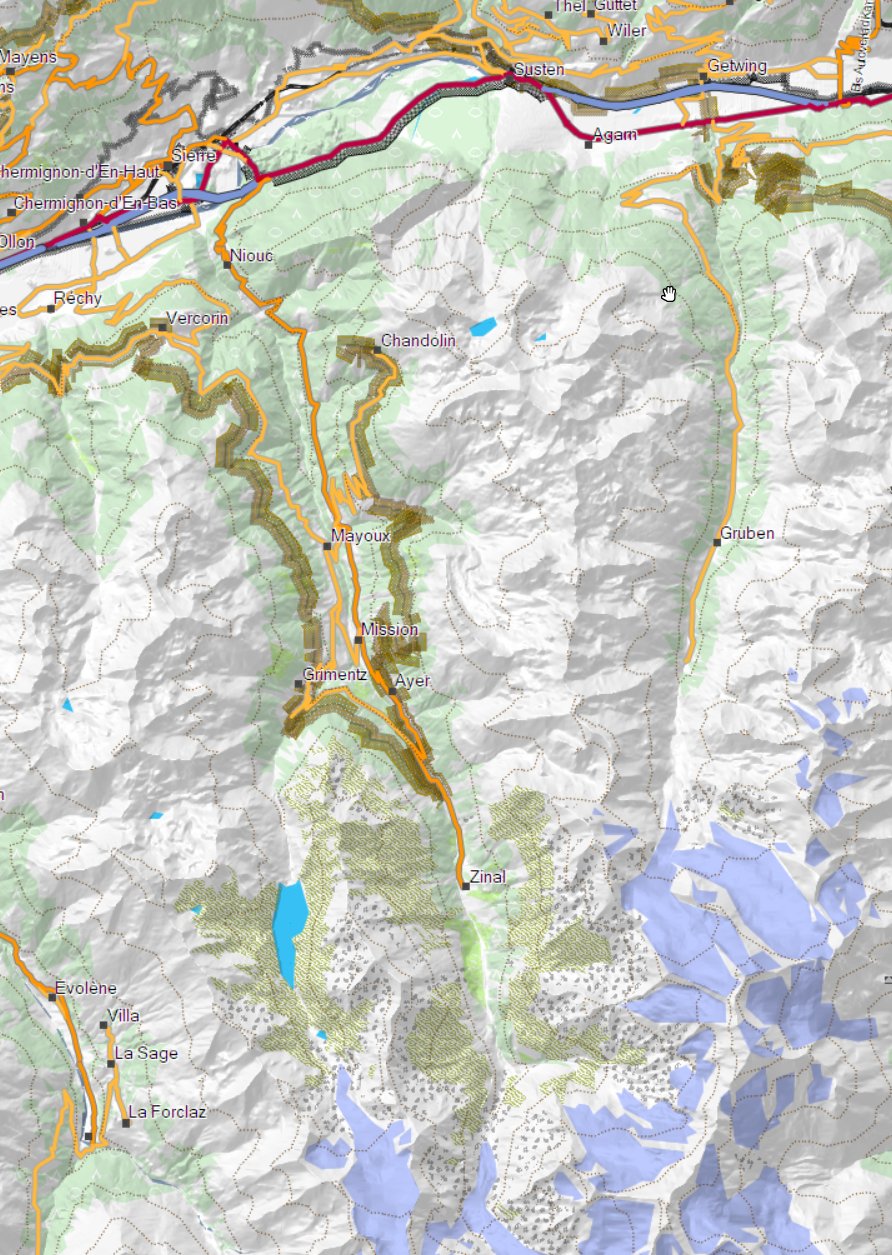
Raxseilbahn in Lower Austria - like this with 0% altitude exaggeration the 3D view is pretty nice for planning!
Leave a Reply
You must be logged in to post a comment.