All OpenMTBMaps and VeloMaps now with DEM – Digital Elevation Model plus countless improvements

Some of you may have noticed - that the European country maps since last week now include a DEM - digital elevation model in addition to the contourlines. Todays and Tomorrows map update will now bring DEM to all maps - this has quite a few advantages. E.g. altitude profiles for tracks, a more plastic and easier to understand topography overview in Basecamp on desktop - and the quite useful 3D view in Basecamp (make sure to set elevation exaggeration in Options --> Display --> scroll down to 3D to 0% - the default 100% is really too much inside the Alps. 
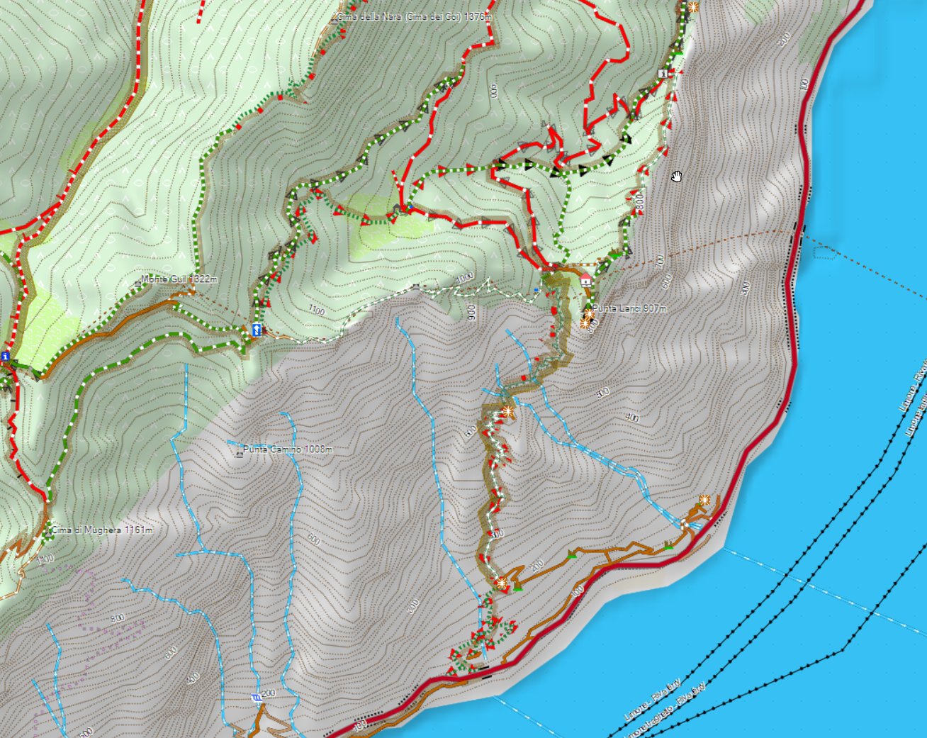
Lago die Garda 2D with DEM

above the Lago die Garda and some of it's nicest trails - notice the DEM shading....


On your Garmin GPS device I have so far not enabled DEM (if you set show DEM to auto it will not show) - I'm working on adding this a couple of weeks later - but as it is only useful when zoomed out very far (if you're zoomed in close it only makes the map darker - and the GPS device screen is too small to properly see the altitude profile properly if zoomed in close). I may add in future DEM shading for devices for zoom levels 5km or 10km to 30km - this helps understanding the topography a bit - however even though I looked at optimizing this as well as possible - it still slows down the map drawing when panning the map around quite substantially (it's not too bad as first the map is drawn - then in a second step it's shaded). I will need to do some further tests on this before it will be released however.
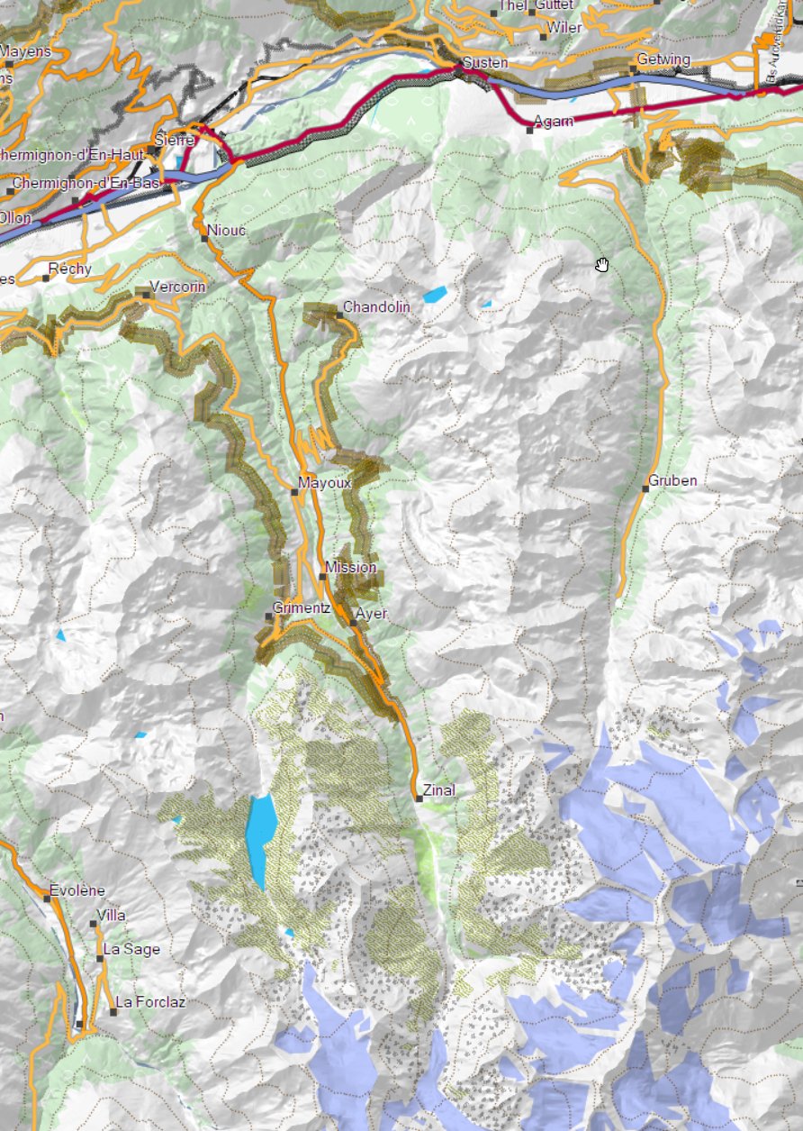
My favourite place in Europe for Mtbiking - the Val D'Anniviers

For maps where the contourlines are not integrated but as a separate download - this may cause some chaos tomorrow as the old contourlines are replaced on server as the openmtbmap is created on server - but it may take some time to be downloadable on the FTP server. Especially for the VeloMaps tomorrow there will be many countries where the new contourlines are already online, but the map is not yet. European maps are not affected here however - and the OSx OpenMTBMaps are also not affected. However make sure especially on OSx that you do not reuse your old contourlines if the map is compiled Yesterday or newer! On windows the new installer will throw an error if you provide the old contourlines however the old installer (if map is older than yesterday) will happily unpack the new contourlines and the map will be broken (no contourlines visible - and when you try to send it to device it will fail).

As for some countries the contourlines including DEM became too big (5 countries overall, in Europe only Norway) those countries now have contourlines as external download. I'm sorry that for Norway last week the contourlines v3 download was not online until 2 days ago (so 4 days after the map update). 
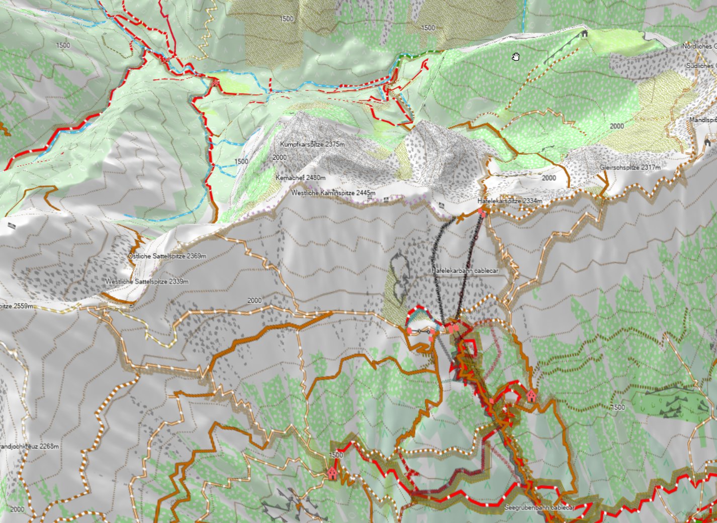
Note here I am using 100% 3D exaggeration - this looks impressive but is not good for planning routes

Above Picture shows the Nordkette in Innsbruck with 100% 3D exaggeration - notice that on the backside - you cannot see much anymore. Therefore I advise to stay away from the exaggeration for planning - it's nice for looking at it though.


The next update of the Europe map (mid next week) will then also see DEM - it will be the last map to be changed to include DEM though.


In some places when routing along over the last 1-3 years the openmtbmaps and velomaps did cause crashes (fine if not using autorouting) - this was due to OSM mapping errors - in combination of my maps being aggressively tuned for best routing for MTBs and bicycles - most of these are now solved in software - and not problematic anymore (especially roundabouts were problematic). There are still a very few places where this can happen (maybe 40 in Germany, 50 in Italy, 10 in Austria and so on) - and I hope that at least 90% of those remaining will also be solved soon. The problem is always related to people drawing roads on top of each other in OSM without noticing their mistake - if then at least one of the overlaying incorrect ways is part of a hiking, bicycle or MTB relation (route) this likely caused problems. Also some super detailed areas where people drew roads shorter than 5m into OSM were problematic (this is 99% solved now).


Also last week only, some software misconfiguration caused some maps not to be digitally signed - and virus scanners running havoc - this is fixed in todays map update too - Sorry for the glitch it happened as I cleaned up the OS to dig out HDD space.


blank

Raxseilbahn in Lower Austria - like this with 0% altitude exaggeration the 3D view is pretty nice for planning!

Mappe localizzate vs inglese

Negli ultimi 2 mesi ho investito diverso tempo per ottimizzare la gestione delle lingue/codifiche delle OpenMTBMaps e VeloMaps.

Originariamente avevo implementato un sistema molto complesso per rendere utilizzabili le mappe anche per chi non parlava il linguaggio locali, o le persone non in grado di leggere ad esempio l'arabo o il cirillico. Alla fine è diventato tutto confusionario anche se funzionava per molti paesi.

Adesso ho cambiato questo sistema, ci sono mappe localizzate, tradotti in lingua con i caratteri locali, e mappe in inglese per tutti i paesi che non utilizzano principalmente caratteri latini.

Anche le mappe dei continenti (ad eccezione dell'Antartide e il Nord America che parlano comunque inglese) sono ora tradotte in Inglese o tradotte. le mappe relative al Sud America/Centro America saranno disponibili per il download da domani.

Se trovassi qualcosa che non funziona lascia un commento. Specialmente se dovessi trovare chiavi OSM che non sono ancora implementate e volessi aiutare nella traduzione delle mappe.

Aggiornamento delle mappe:

Le mappe che non sono disponibili in Inglese saranno aggiornate settimanalmente come prima. Tutte le mappe che sono disponibili anche in inglese saranno aggiornate ogni 2 settimane, alternando l'aggiornamento in inglese nella prima settimana e l'aggiornamento in lingua locale nella seconda settimana e così via.

Chi ha bisogno delle mappe Unicode - reminder:

Garmin ha bloccato la lettura delle mappe libere Unicode circa 2 anni fa nei suoi nuovi dispositivi.
Ad ogni modo cercando nei meandri di internet si trovano firware per questi dispositivi che non leggono le mappe in Unicode, in cui una piccola parte del firmware è stata rimossa. Se utilizzate questi firmware modificati per visualizzare solo le mappe libere in Unicode dovrebbe essere legale, per lo meno nell'Unione Europea.
Non è legale invece utilizzare questi firmware per visualizzare mappe "pirata" originali Garmin.
In generale nei paesi non latini le mappe Unicode saranno superiori!

Notate bene: non vi aiuterò a trovare questi tipi di firmware, potete utilizzare Google per sapere di più a riguardo.

Sia le mappe Unicode che non Unicode sono disponibili in lingua e in inglese:

Mappe Unicode localizzate: Queste mappe utilizzano lingua e caratteri localizzati, inoltre per la ricerca dei POI delle città solitamente è possibile utilizzre l'inglese.
Quindi la citta Mosca in Russia sarà visualizzata come Москва ma si potrà trovare nella ricerca dei POI anche con la dicitura Moscow (e anche in italiano come Mosca).
La ricerca degli indirizzi invece funzionerà solamente nella lingua locale, quindi sarà necessario digitare: Москва come città nella ricerca indirizzi.
Nella ricerca POI saranno consentiti Москва, Moscow o Mosca.


Unicode english language maps: These maps use English as label whenever possible (meaning in OSM database). If no English translation is available the maps tries to use English transcription from OSM database. If also no transcription exists - the map will show local language names.

POI search is possible in English, local Language and German language. Adress search is possible in English whenever English exists in OSM - else in local language.

Moscow will be used as a city for address search. POI search Moscow, Moskau or Москва is findable.

Non Unicode local language maps: These maps use local codepage (excpet for Chinese and Japanese where Garmin does not offer a non unicode codepage that can display the characters) and local naming. POI search is possible in English, German and local language.

Moscow in address search will be found under Moscow only. In POI search it can be found under Moscow, Moskau or Москва (as kyrillic codepage supports enough character to spell moscow also in latin)

Non Unicode english maps: These maps are in latin only. Maps uses English wherever available in OSM, if not then Transcription from OSM, if also not available a machine transcription is used - which is a bit faulty however!

Address Search is only possible in latin script - and often not working as you cannot guess the automatic transcription used for a streetname. As city names in OSM tend to exist also in English or proper transcription address search for a city or POI search usually works still okay. POI search in local script is not possible.

Moscow can be found under Moscow or Moskau - but not Москва